Being a native Oregonian and having done most of my flying in the Pacific Northwest, when Sérgio announced that he wanted to do a review of ORBX TE Oregon, I naturally jumped at the opportunity. Without boring you with too much backstory, the excitement I always harbored flying around Oregon in my first five hundred hours has been seldom matched in any of my other flying experiences. Oregon is just a magical place; there are few other states where you can get a taste of everything.
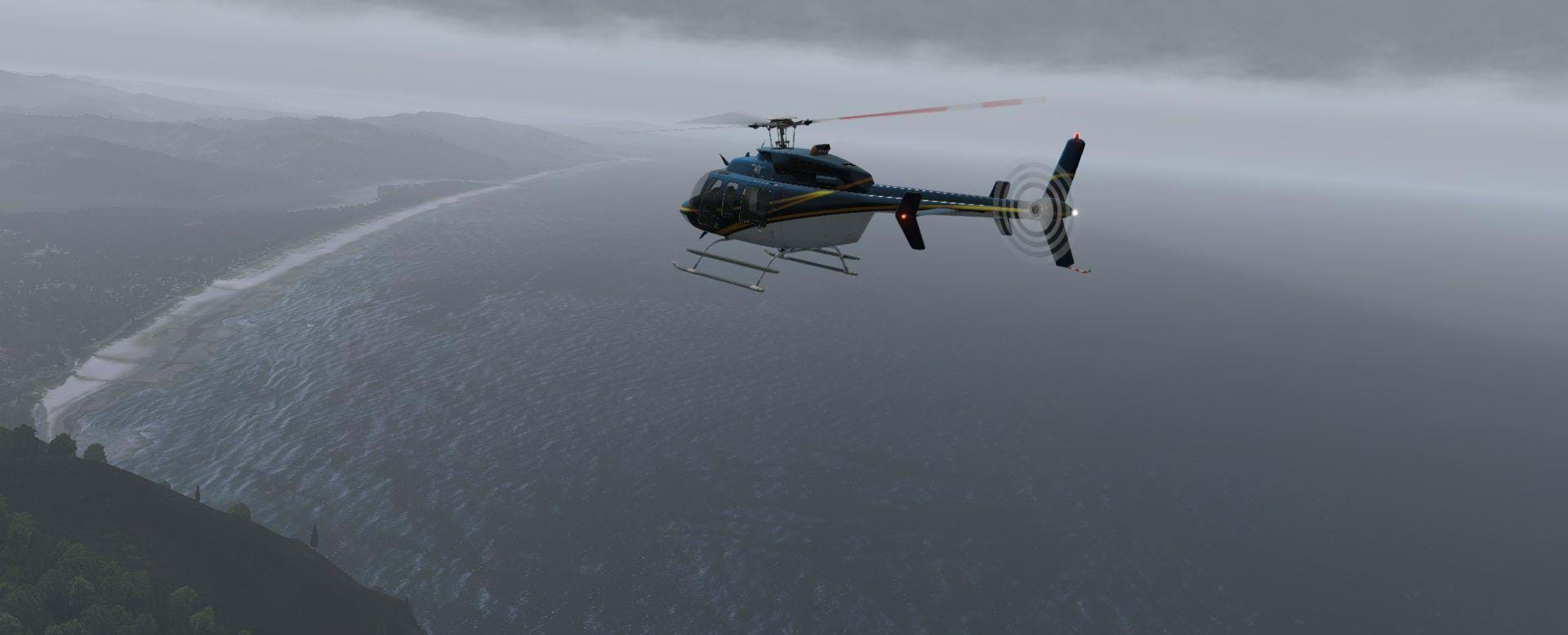
Let me explain what I’m on about: Oregon sits nearly smack-dab in the middle of the west coast of the United States (colloquially known as the Pacific Northwest). Divided by the coast range, the Pacific Ocean and nearly 350 miles of picturesque public beach are off to the west. Separated by the Cascades, the high-desert, painted hills and Columbia plateau climb to meet the Rockies to the east.
Crater lake and its nearly 2,000 feet of crystal blue water is to the south and cut down the middle is the Willamette Valley. The state is divided by some definitive landmarks as well. To the North, the mighty Columbia boarders Washington and joins the turbulent Snake dividing Idaho and Oregon. The massive Klamath Lake warns you before you delve into California and straddling the Valley is the Cascades.
If you’re flying west, fly until you hit the big blue thing. If you’re flying east, take a pressurized aircraft. If you’re flying north or south, stay in the valley. Oregon really is a state that encompasses flying for every walk of aviation.
The True Earth Series
Just in case you’ve been living under a simulator rock, the True Earth series by ORBX is built for X-Plane 11 and Oregon is the fifth installment for that series. Originally starting with three releases for Britain, Washington followed shortly and then Oregon joins the group seamlessly connecting Oregon/Washington.
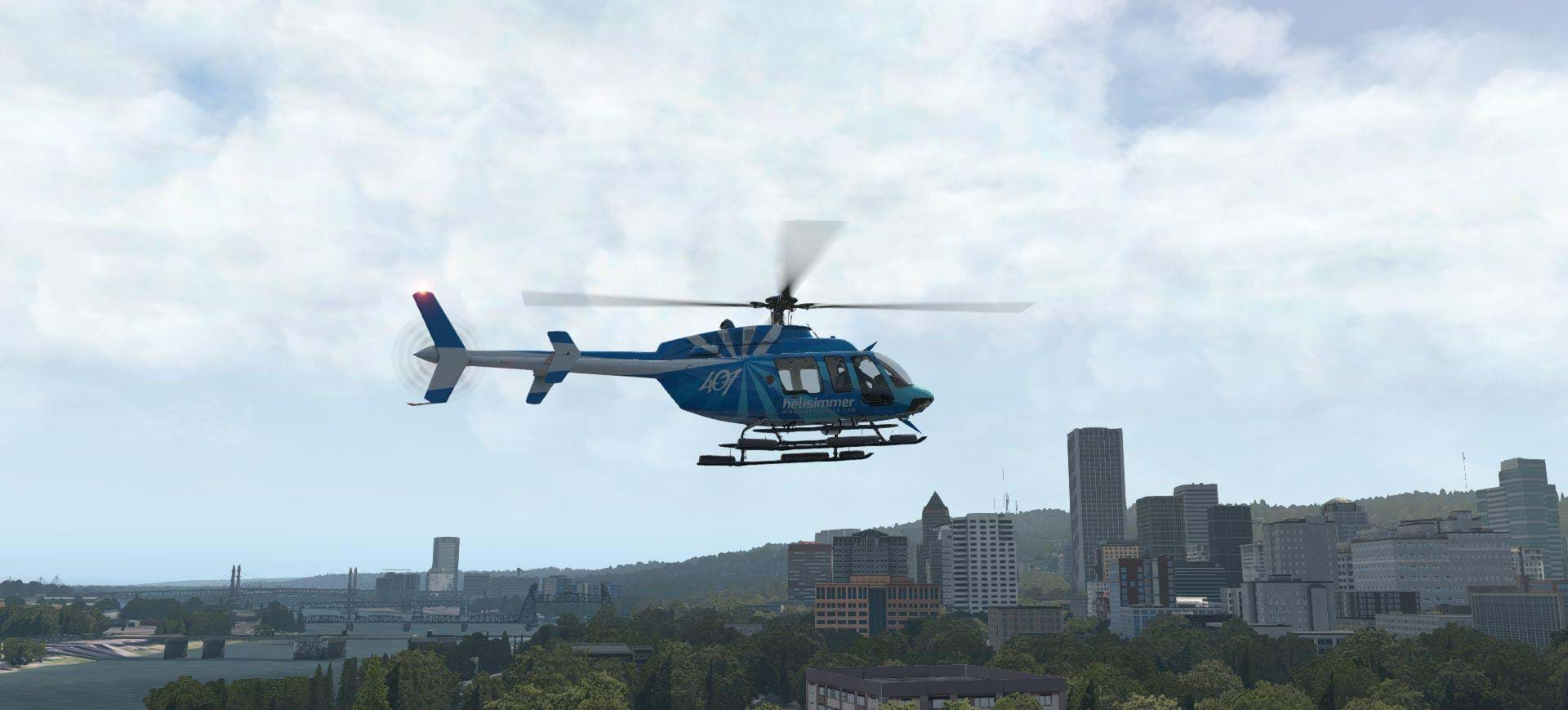
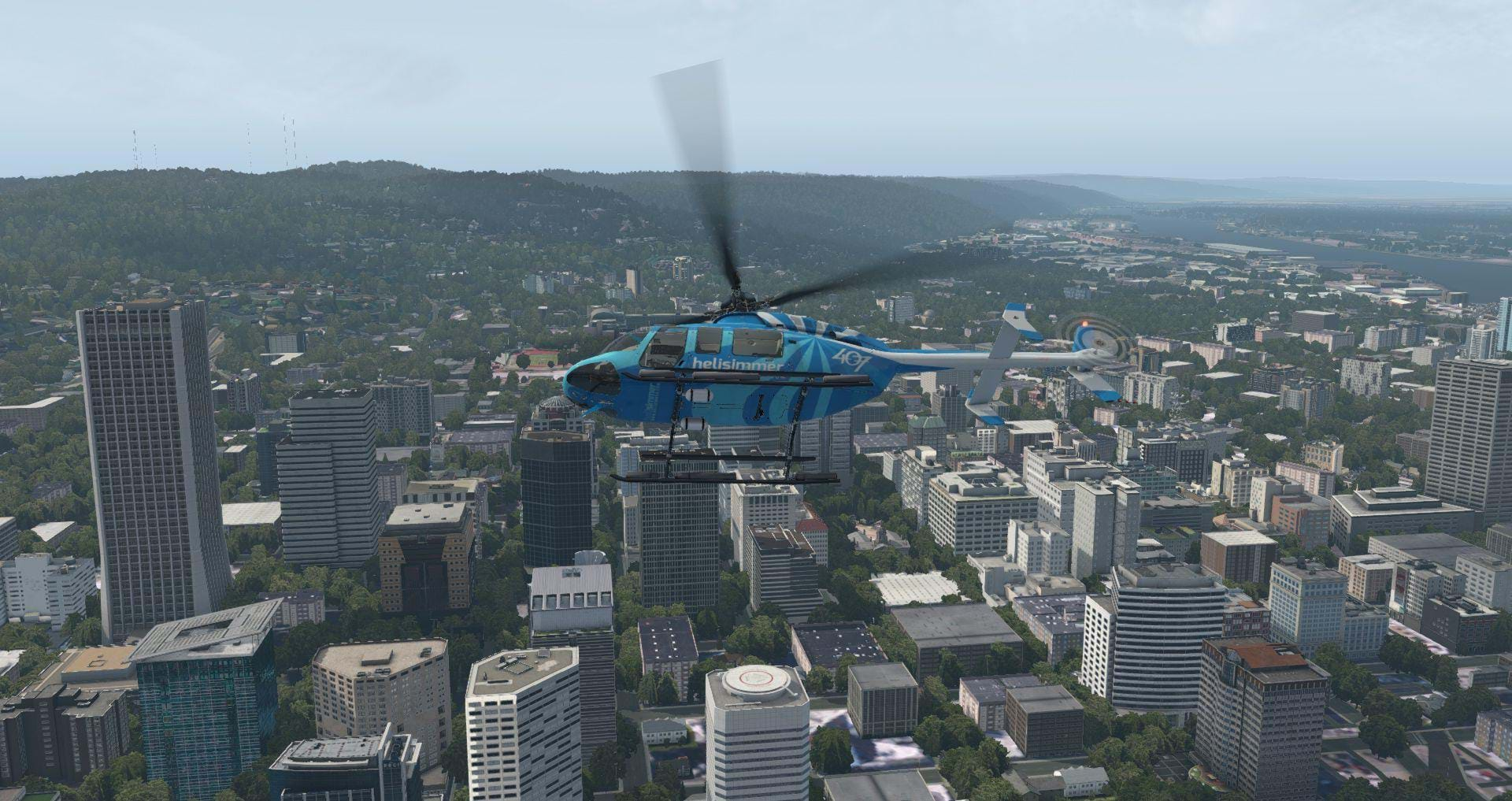
What’s exciting about Oregon is the level of rotary-wing aviation that stems from the area. Hillsboro Helicopters (part of Hillsboro Aviation) is based out of Hillsboro, Troutdale and Mulino and serve the Portland-Metro area. Columbia helicopters are based out of Aurora and several smaller companies serve the bustling logging community prevalent throughout the region.
ORBX utilizes LiDAR to do a ground mapping of the region and then import that data into the simulator to build the terrain whereupon, they take high definition orthoimagery (ZL17 - 1.2m/pixel) and drape that over the 10m Digital Elevation Model (DEM). Other key features include physically-based render (PBR) enhanced Portland’s cityscape, custom water-masking and over a thousand custom points-of-interest.
The result of all this? Gorgeous replication of my home state and one of my favorite locations to fly. I cannot accurately describe how excited I was to hear that my home state was undergoing the ORBX treatment. And for the most part, it did not disappoint. The hub of Oregon, Portland, was beautifully recreated and in HD, PBR glory. It was amazing to fly around and recognize many of the landmarks that I’ve not only flown over in real life but also, have specific memories for. The level of immersion is amazing.
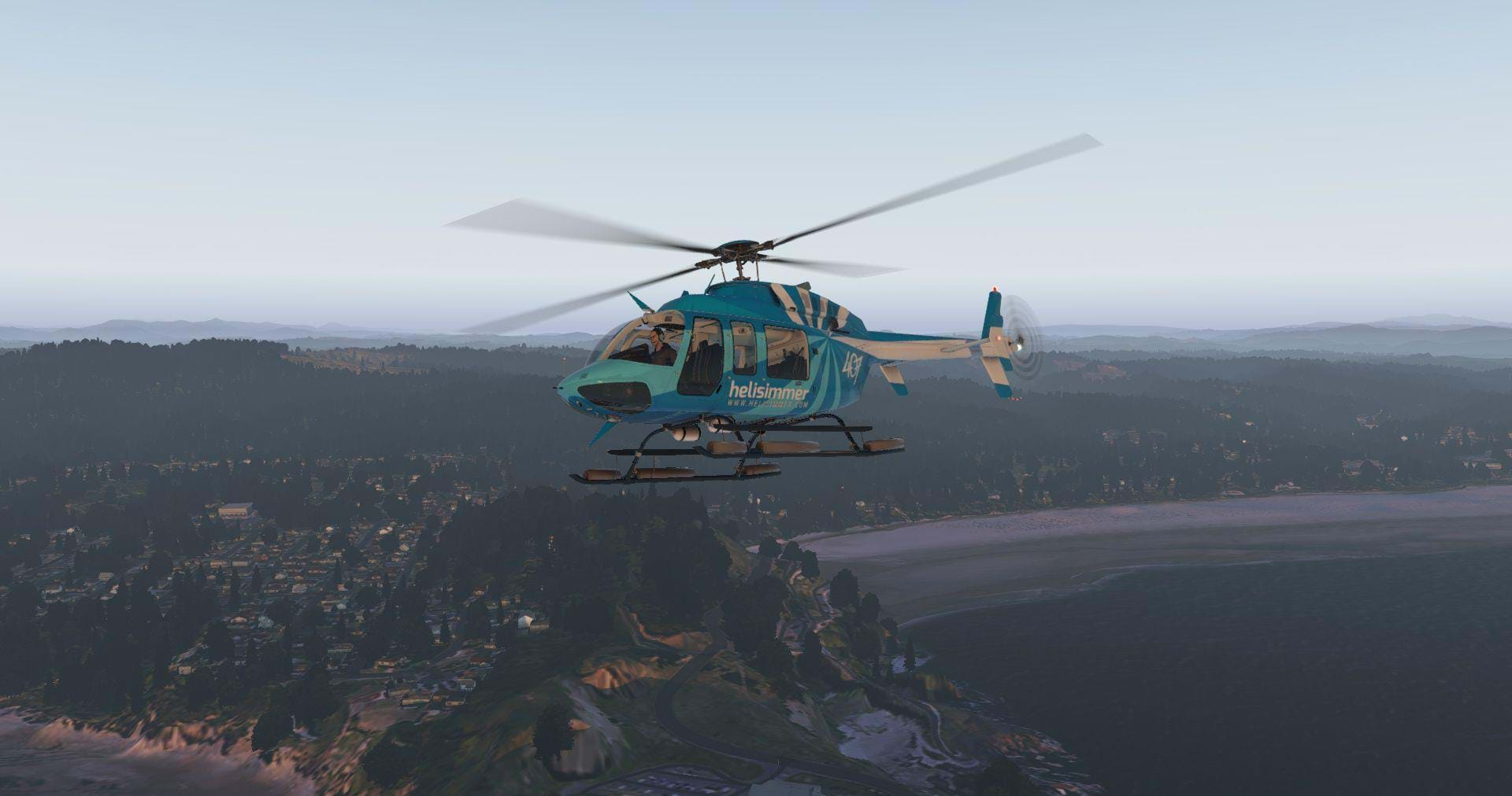
The LiDAR and ground mapping is pretty spot on for most of the state, familiar terrain features falling into sharp relief which makes VFR flying a breeze. Although this review is specifically aimed at helicopters, in order to see Oregon in some of its beauty you really need to step up in altitude to get out over the Cascade Mountain range and see some of work done on the mountain range itself.
The foothills of the Cascades ripple as spurs and cuts slice up the mountain where glaciers had previously carved through the terrain. On the eastern side of the Cascades, Sisters, Sunriver and Bend provide a starkly different scene. High desert plateaus and massive lava flows carve through the terrain and create fantastic opportunities for helicopter pilots that enjoy ducking and diving through deep trench ravines and spill-ways.
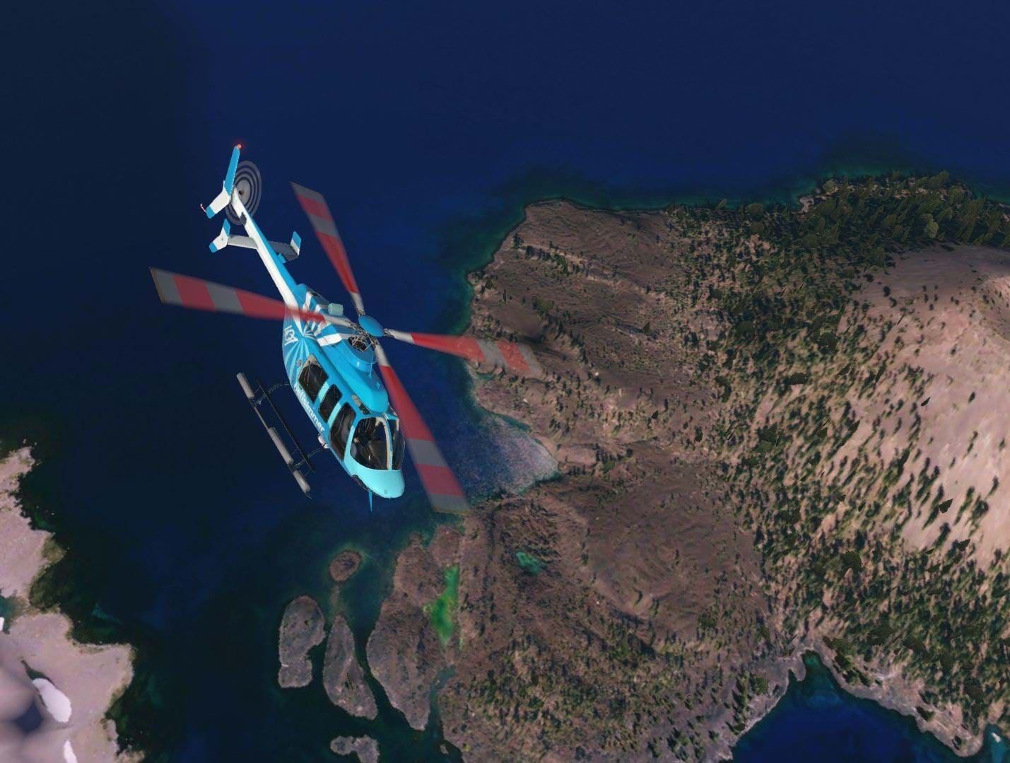
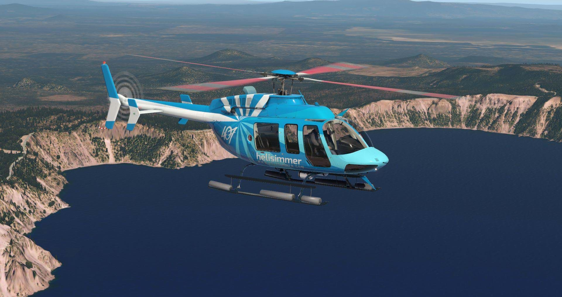
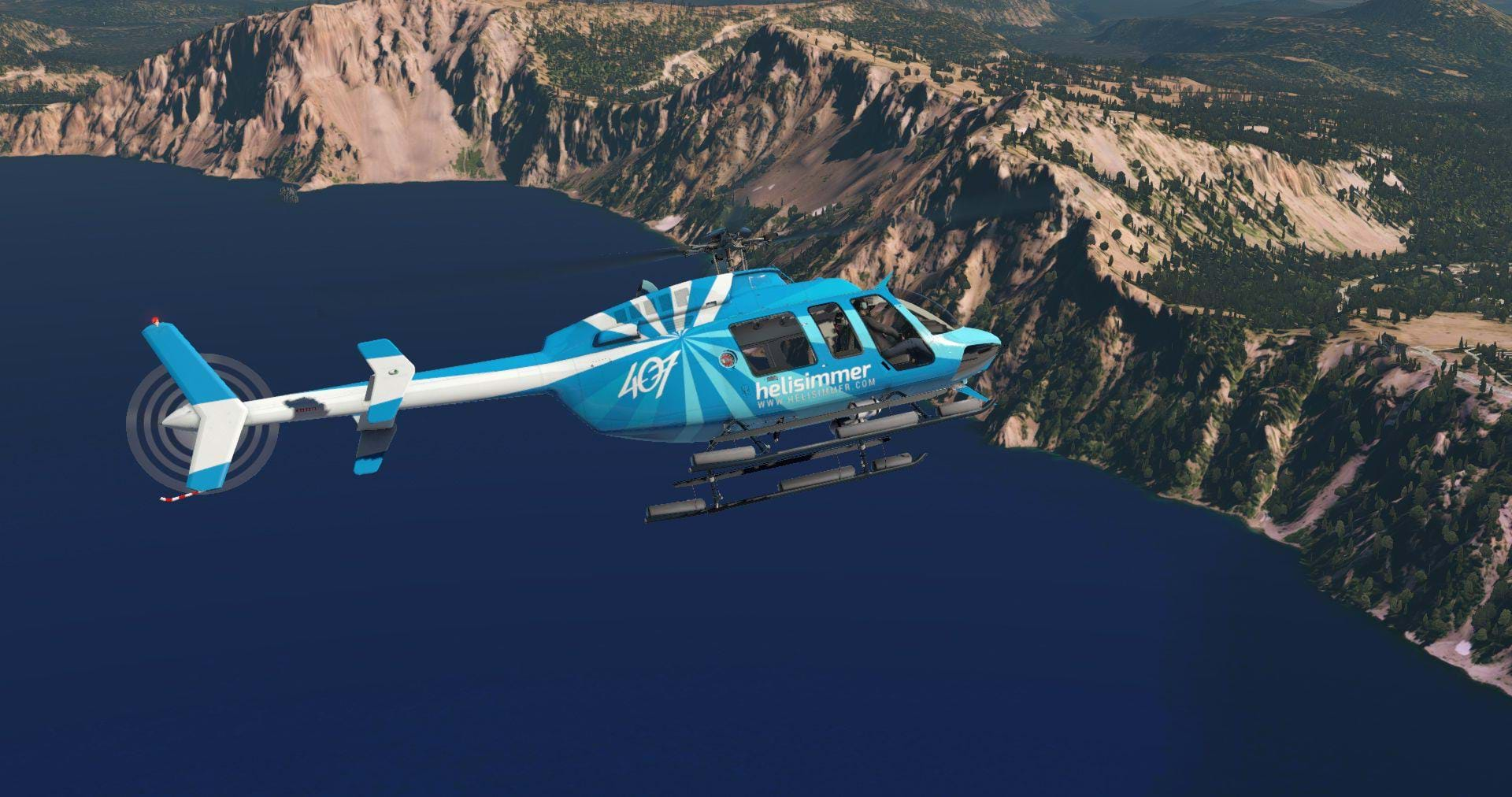
South, Crater Lake stands out like the gem that is it. Crater Lake is well known as being the second deepest freshwater lake in America and one of only a handful (of its type) throughout the world. What originally started out as a volcano, erupted about 10,000 years ago. The central caldera collapsed, creating one of the most serenely beautiful spots in the world.
ORBX did a fantastic job catering TE Oregon for a range of different users. With the purchase of the package, the customer is provided with two different sceneries. High-Definition Oregon is utilizes ZL17-level zoom for the overlays and provides a picturesque region for helicopter and GA pilots alike. Additionally, there is a Standard-Definition provided with the package that is better suited for pilots that may have lower end systems or use virtual reality.
I tried both installations of ORBX TE Oregon and found both to be satisfactory for general aviation flying (specifically 2,000 feet or higher) and saw no discernible visual difference between the two from those altitudes. However, when down lower it was apparent that there were some changes to the overlay itself. At lower altitudes, the imagery lost definition and objects became harder to discern.
With HD in VR, I consistently saw 20+ Frames per second (FPS) in all areas except Portland where frames dropped to 15 depending on the aircraft. For aircraft that utilized high-poly count objects and multiple plugins, frames would drop down to 5 which naturally, made flying unmanageable. Switching to the SD version, around out-lying area’s and outside of cities, I would see frames easily hit 35+ but again, in Portland, frames would drop to 10.
Again, high frame rate drops would only occur with aircraft that utilized extensive PBR texturing, multiple plugins or other amenities that required lots of resources. With the DreamFoil 407 or freeware MD500, I could fly easily around Portland and the metro area with all the sliders maxed (with the exception of anti-aliasing) and still see 20+ frames consistently. If you’re a user that prefers VR or has anything less than a 1070X I would recommend utilizing the SD version. If you only intend to fly helicopters and can afford the resources, then use the HD version.
Also new to the ORBX interface and TE Oregon being my first interaction with it, ORBX Central is a refreshing over-haul to the older FTX Central interface. Whereas I consistently had issues installing TE Great Britain and TE Washington, TE Oregon installed seamlessly
Room for improvement
Sadly, there are discrepancies to note. Let me preface this section to also state that the same issues I’m about to discuss, are issues that I’ve noticed throughout all of the TE series.
- Several helipads have no functionality: Portland is known for its downtown heliport located right on the Willamette river. Although, frustratingly, the helipad is completely non-functional.
Located in Old Chinatown on a parking garage at the intersection of Naito Parkway and Davis street, the helipad is a welcoming treat to student pilots working on their helicopter private pilot license. Also, of note, the helipad located on the Oregon Health and Sciences University is non-present as well as St. Vincent Hospital located off the highway 26 and 217 interchange.
What frustrated me about the two hospitals is that ORBX went through considerable effort to create 3D custom autogen for those landmarks but missed out on the heliports (although at St., Vincent the ortho-imagery shows the heliport).
Other examples in the TE sceneries include: Downtown London heliport or the Seattle hospital heliports. If ORBX were making a scenery specifically catered to any other function other than aviation, I would understand glazing over these spots. However, if ORBX is going to bother doing custom autogen for these areas’ is it too difficult to include beautiful helipads? It would add authenticity to their sceneries and appease us rotor heads. Please ORBX, start thinking of the helipads!
- Portland International is undisputedly the hub for commercial aviation into the region. Although PDX is dismal. This wouldn’t be too much of an issue were it easy to make Mr. X’s beautiful freeware PDX scenery work or, if we could expect an ORBX re-make of the airport.
Although, if TE Washington is any indication, I’m not sure we can expect an airport over-haul and currently it falls significantly short of Mr. X’s offering. Although - if I’m wrong, if we can expect an ORBX KPDX or KSEA, please let us know and we’ll anxiously await their release. - ZL17 and terrain resolution. I’ve previously had Ortho4XP installed in the region (at ZL17) and I fully expected to clearly make out defined road and streets I was very familiar with. However, I was disappointed.
I found that the ZL17 had poor resolution in several area (specifically downtown and the metro area) and that the imagery used had odd color variations throughout isolated regions. Specifically, Hillsboro Municipal (KHIO) had pink grass and other area’s varied between fall and spring textures - to be fair, I think I only spotted that because I know the area very well.
Additionally, I noticed several airports did not align with the satellite imagery and in some cases, the runway would be offset to where the imagery showed the runway to actually be. To be fair, I think that’s an X-Plane issue rather than an ORBX issue, but it still was pretty shocking how often I witnessed that to be the case (I counted four).
ORBX also forgot something pretty critical: in other TE series, grass and gravel textures are apparent lower to the ground. In Oregon, there isn’t any! This makes hovering pretty challenging over grass/dirt where helicopters frequently operate.
Conclusion
Okay, so now that I’ve beaten up ORBX to make native Oregonians happy with the review and some of our disappointments, let me wrap this review up with some more of the great.
The numerous custom POI’s are beautifully re-created. Crater Lake, Haystack Rock (Goonies never say die!!), John Day and Portland itself look beautiful and is so well made that in several instances, I almost forgot I was sitting in a simulator. The custom water masks along the Oregon coast are also well done make for some gorgeous vistas.
Is ORBX TE Oregon worth the $44 dollar price tag? Definitely. Its blends seamlessly with TE Washington and provides a significant chunk of wonderfully re-created, easily-packaged scenery for pilots of all aircraft types to fly around. Oregon itself would take a helicopter-pure pilot a few hundred hours to explore alone. Couple that with its seamless transition to Washington and almost an endless number of scenarios can be derived to fly around in.