A few years back, I left FSX behind for X-Plane. It was a more difficult choice back then not because of the flight modeling of course but because of all the time and money I had invested in FSX and FSX addons.
One of my favorite addons for FSX was the Aerosoft US Cities X Los Angeles scenery. This was a game changer for me. I both grew up and learned to fly in the Southern California area. Aerosofts US Cities X Los Angeles paired with PC aviators Mega Scenery X Southern California was to date, the best Los Angeles experience I had in any simulator.
Not only did it have most of the landmarks, it was a helicopter simulation enthusiasts dream, every, and I mean EVERY helipad and heliport was modeled, some in fantastic detail. This scenery was the only thing I ever really missed about FSX after switching to X-Plane as my primary home use simulator.
Not long after switching to FSX, ORBX released their own Southern California scenery for FSX. A huge scenery that covered everything all the way to Vegas. It was interesting, but I had already turned away from FSX, and wasn’t going back.
Now, here in 2020, ORBX has finally brought this scenery to X-Plane. I knew this scenery was coming. Ever since ORBX announced they were making scenery for X-Plane. And I was excited about it. VERY excited. As a matter of fact, I bought this scenery within 30 minutes of its release. I was THAT eager to get into it.
This isn’t my First True earth scenery for X-Plane. Last year I bought TE Washington, as well as the X-Plane versions of some of my favorite ORBX pacific north west sceneries, Anacortez, and Darrington being my favorites.
However, I was a little disappointed in that the features I loved about them, the remote helipads, weren’t functional in the X-Plane version. Darrington in particular. But still, my hopes were high, and my excitement sustained for the release of True earth Southern California. It’s not every day you get scenery from a major developer that covers the area where you grew up right?
So let’s get to it.
Installation
This is where my trouble with this scenery started. To get this scenery, you purchase it directly from ORBX. And install it using ORBX central. ORBX central is a nice concept. You manage all of your ORBX purchaces from there, and are able to install, uninstall, update and repair installations from there.
However sometimes, if you have a slow internet connection, downloads of large files like TE Southern California can be troublesome. It took me just over a day and a half to down load this scenery, after which, I installed it, only to be greeted with an error message and X-Plane crash when I tried to load a flight for the first time.
For those of you who use WiFi at home, I strongly encourage you to use a hard line connection to download this scenery to avoid and issues and to cut down on download time.
A reinstall fixed the issue and I was able to finally load a flight two days after purchasing. I don’t blame ORBX for the long download time. But I was disappointed in a flawed first install.
Welcome to Southern California
Southern California is a great (but expensive) place to live, and an even better place to fly. Like I’ve already mentioned, this is where I’m from. I was born in Southern California and lived there right up until I joined the Army.
It’s also where I learned to fly helicopters, so I know SoCal very well, both from the ground, and the sky. So, I was very excited to see this scenery.
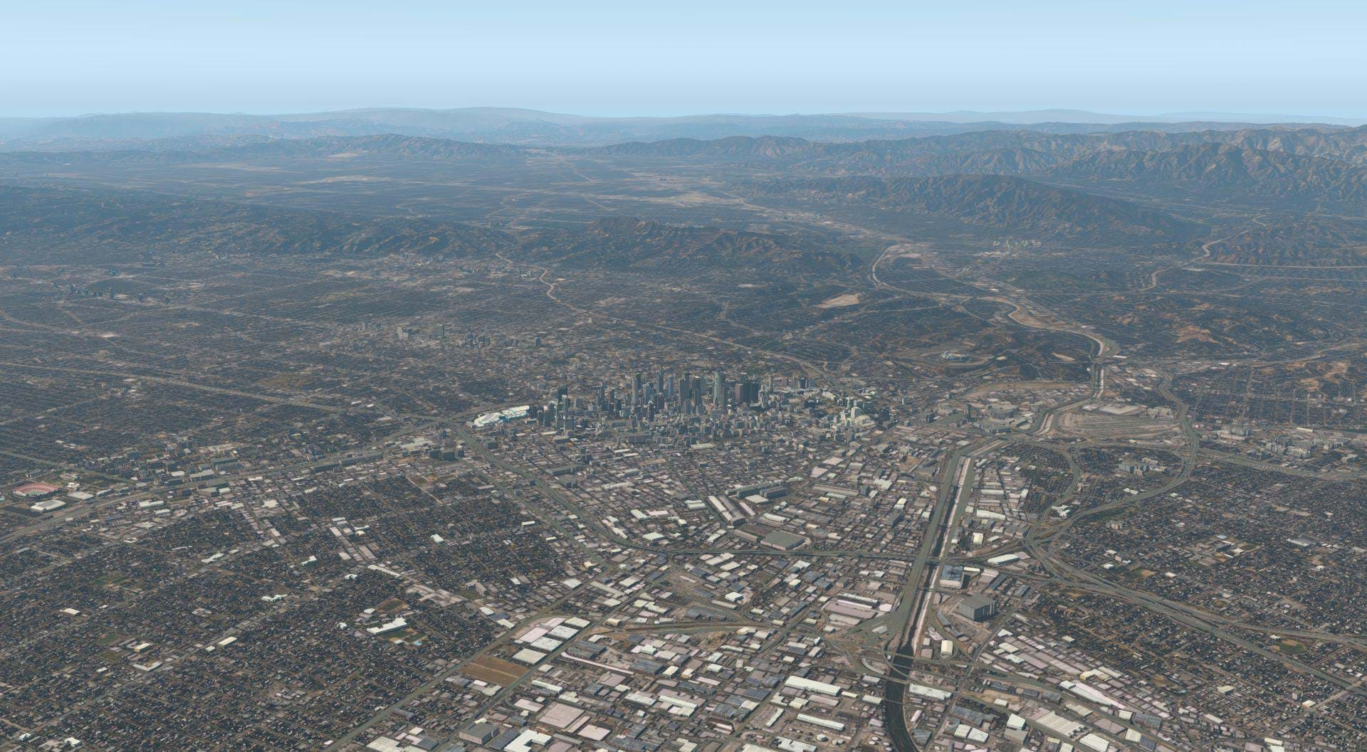
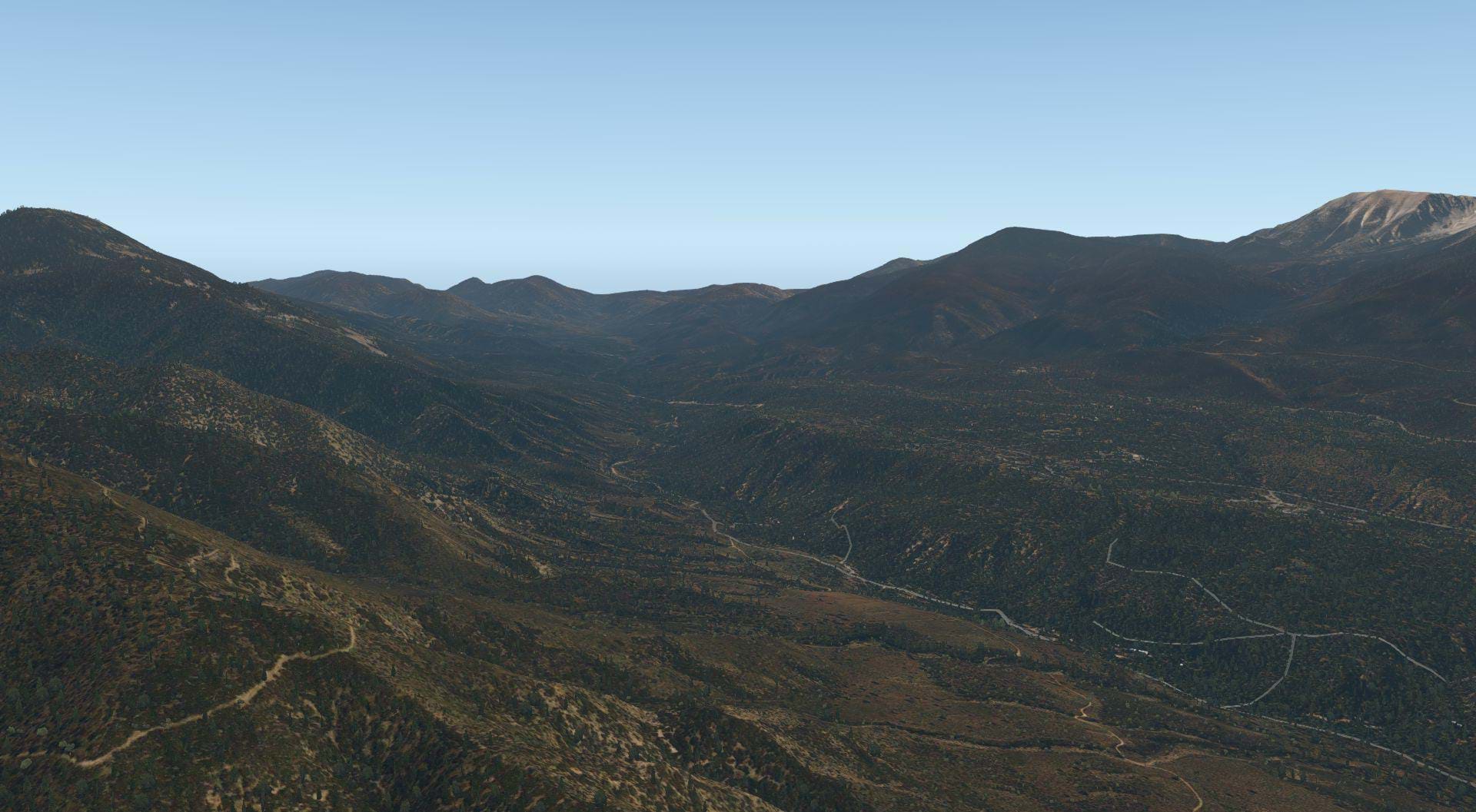
This Scenery covers a very wide area. California is a BIG state that is very diverse, so diverse that it might as well be three separate states. But for now, it’s just one, and ORBX did a pretty good job covering the southern half of the state and showcasing all of the different regions SoCal has to offer.
This review would be 12 volumes long to cover all of it. Because this is a helicopter simulation site, I chose to focus on three counties, San Bernardino, Los Angeles, and Orange counties. I chose these three areas for two reasons.
- These counties are extremely rich with helicopter activity and have a lot of infrastructure to support helicopter operations. Los Angeles is probably one of the most helicopter dense areas in the world.
- I know these areas very well, so it will be easy for me to check the accuracy of the terrain, and 3D models.
Well have a look and some of the other areas of this scenery towards the end of the review, but for now, I’m going to go with what I know!
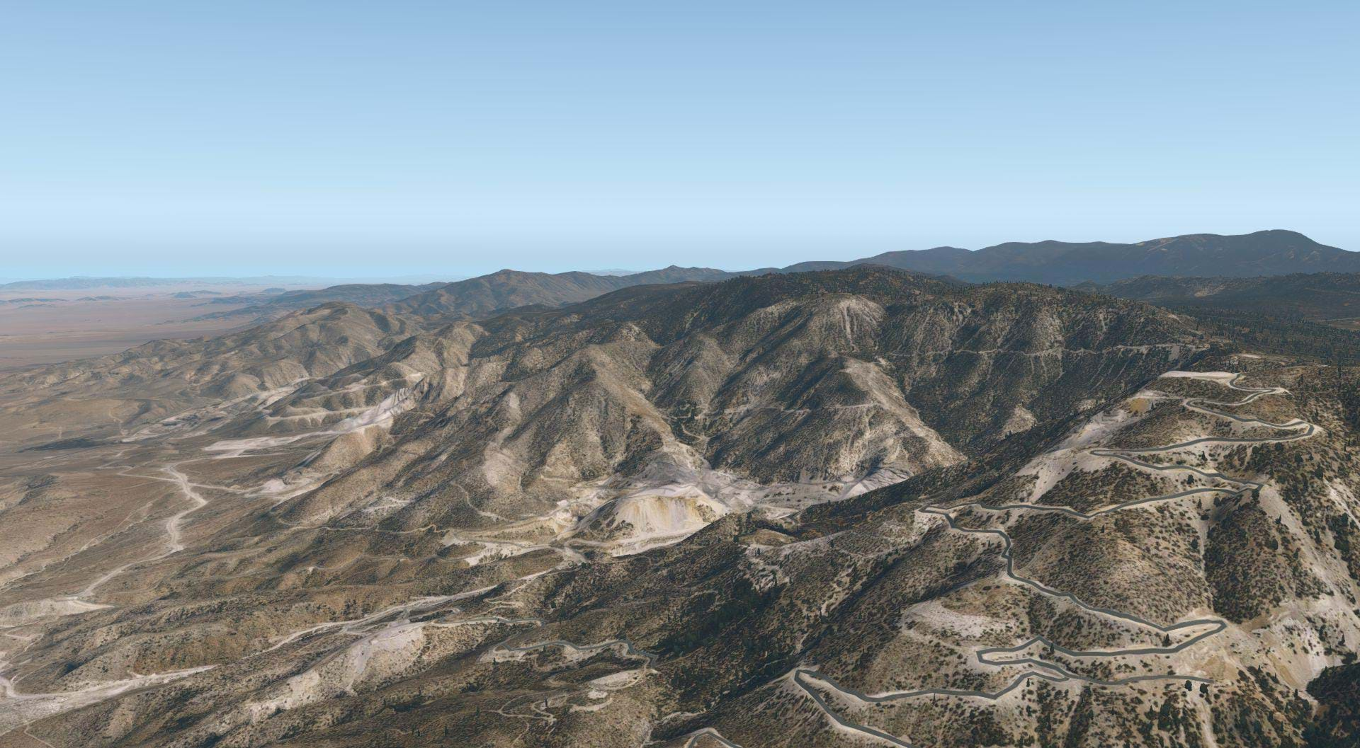
Terrain Mesh and Imagery
The terrain mesh of this scenery is pretty impressive! I’ve been using ortho4XP scenery tiles for this area for years, and have really enjoyed it. The resolution of the terrain mesh is very good!
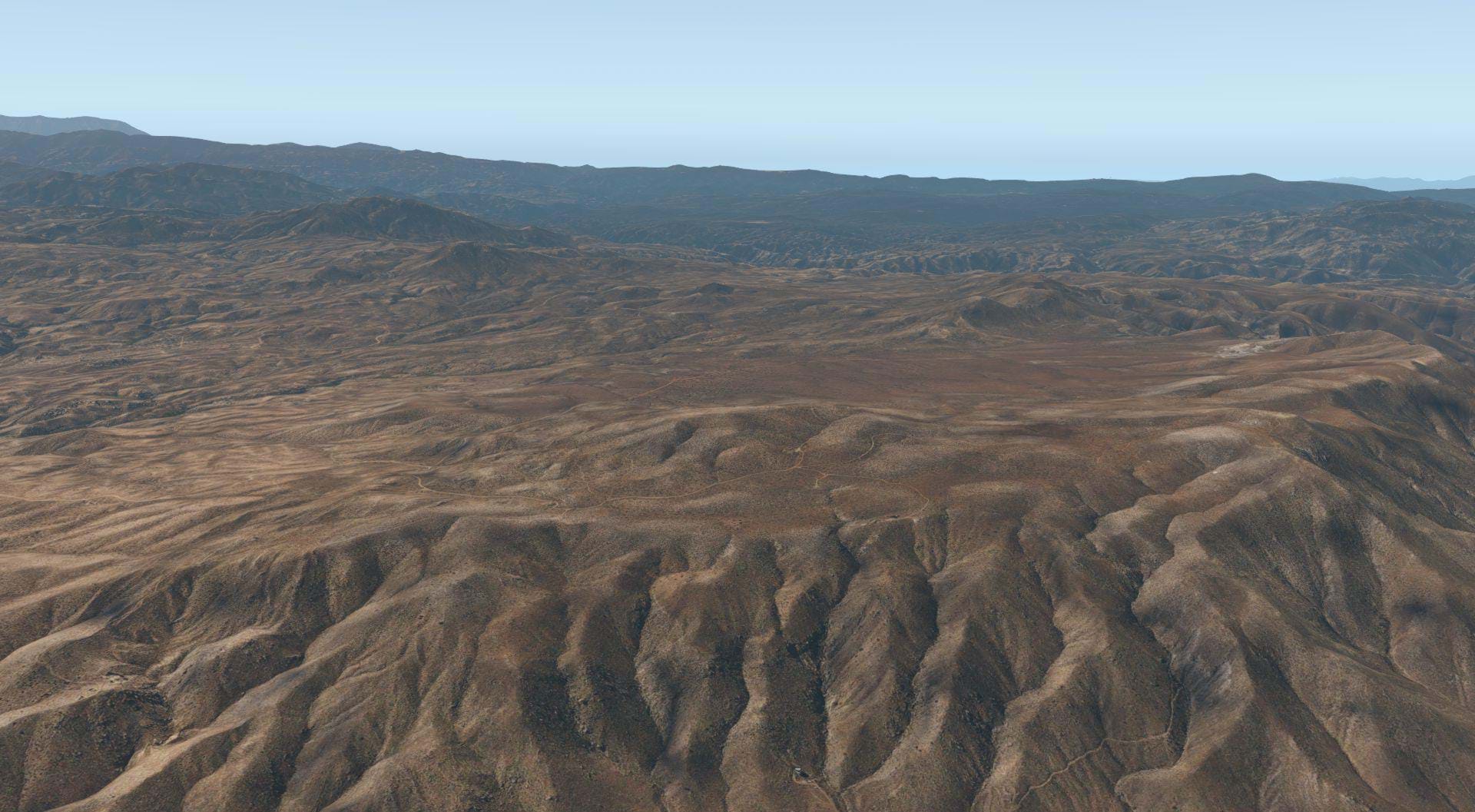
Not perfect, more on that in a minute, but pretty well done, especially in the mountains. There are some hills in the Chino and Diamond Bar areas that are really well done, as well as the Pasadena and Glendale areas. The mountainous areas of the high desert look really good and as well as the and Los Angeles National Forest areas
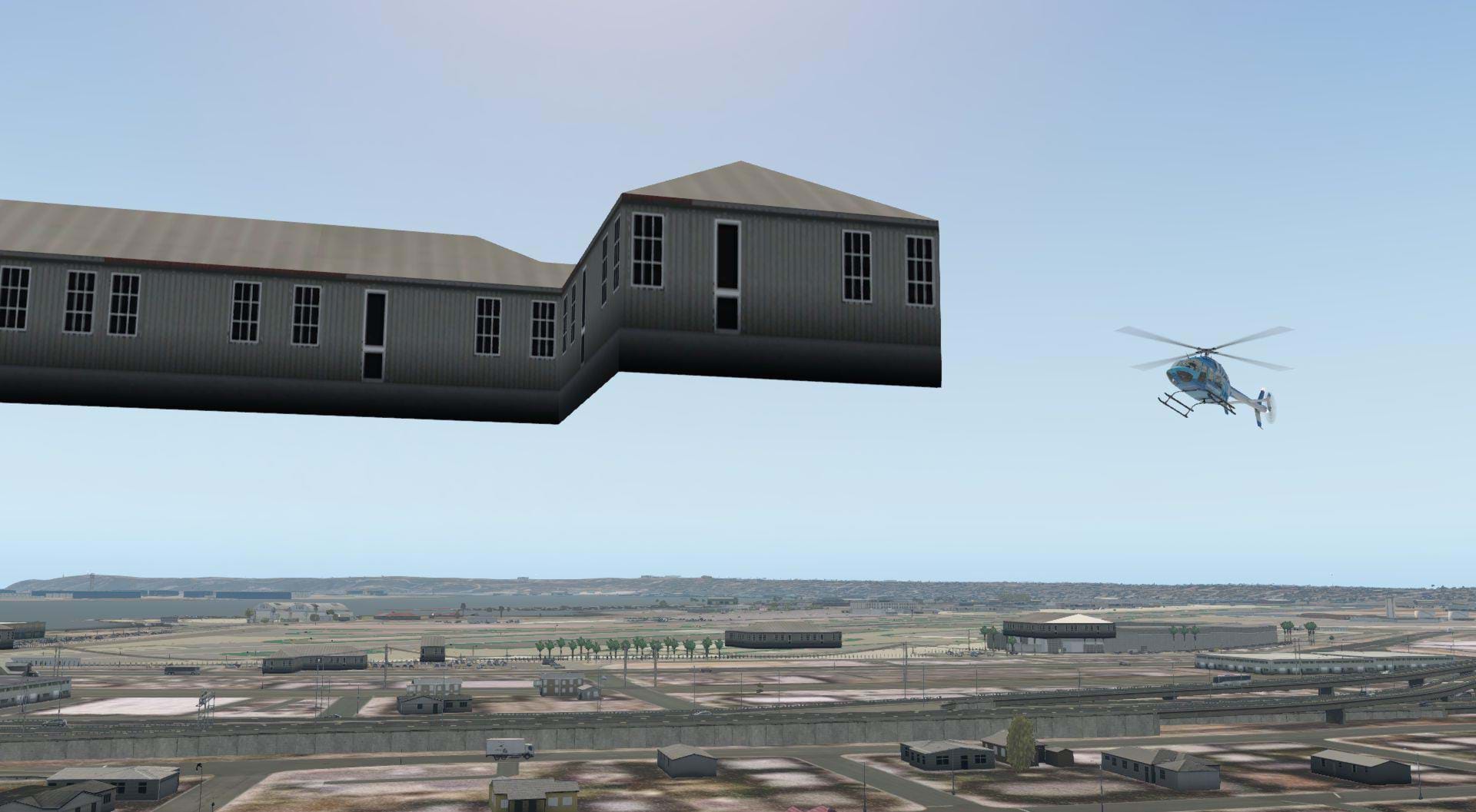
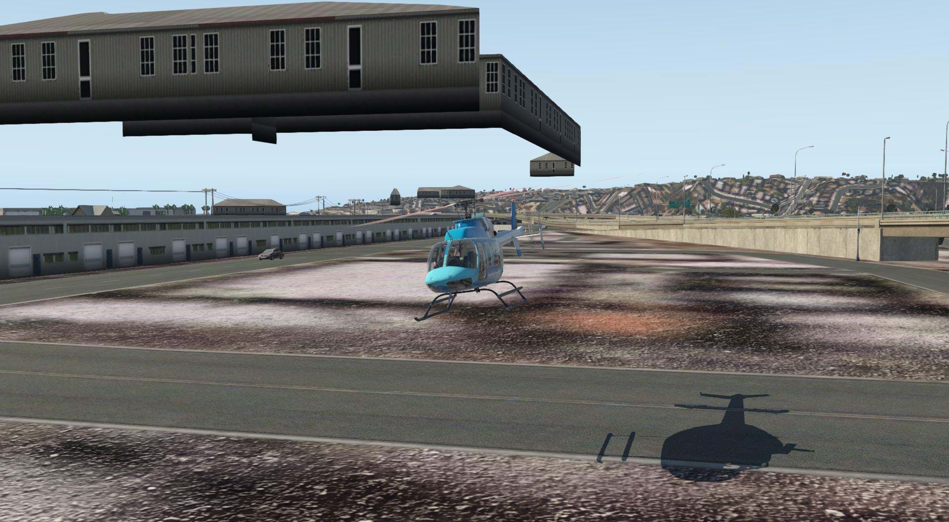
As good as the terrain tends to be, there are some glairing flaws that I noticed. One of the biggest examples is the floating buildings. There are floating buildings everywhere in this scenery package especially in the hills.
So many that I don’t think they had beta tested this scenery with anyone flying below 1000 feet. I understand that not every object can be placed super accurately, but in some cases the altitude of the floating building was excessive. Near the San Diego international Airport, I found a building that was 150ft above the ground. Being so close to a major airport I would have imagined this would have been caught and corrected prior to release.
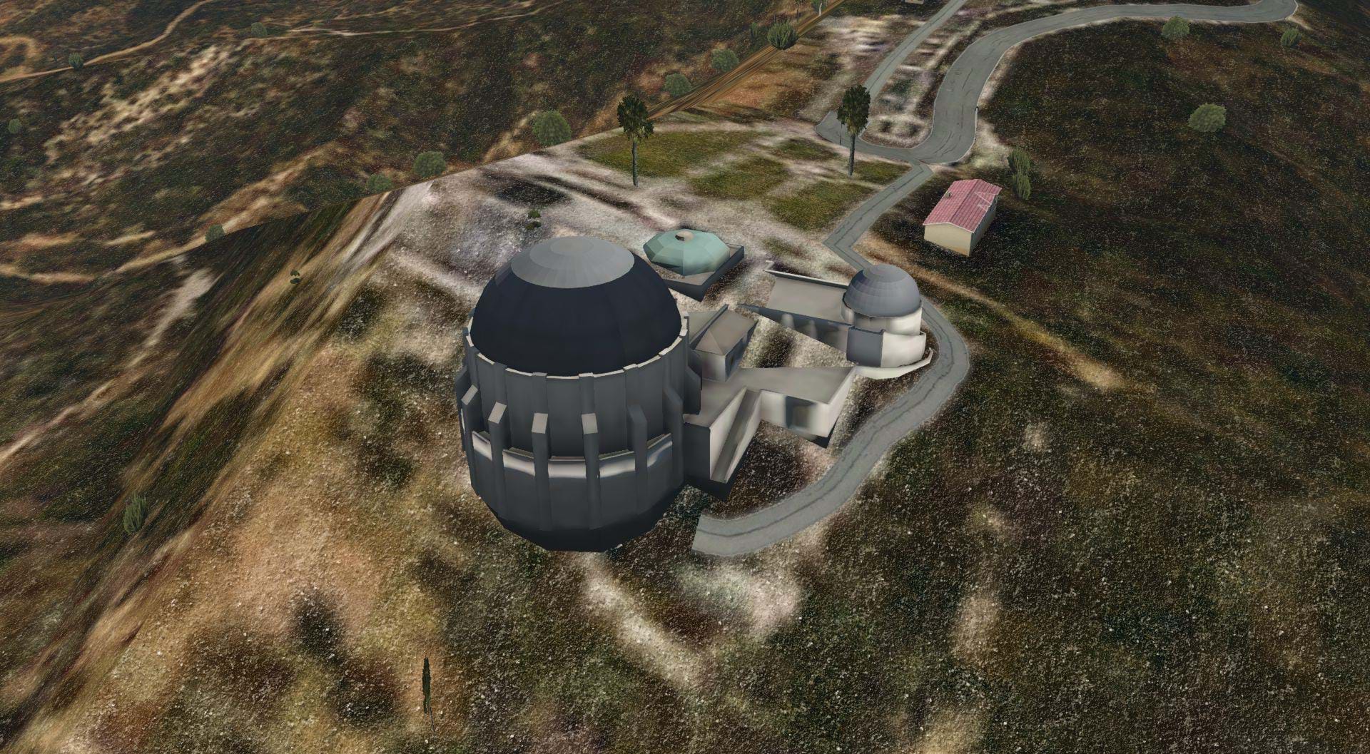
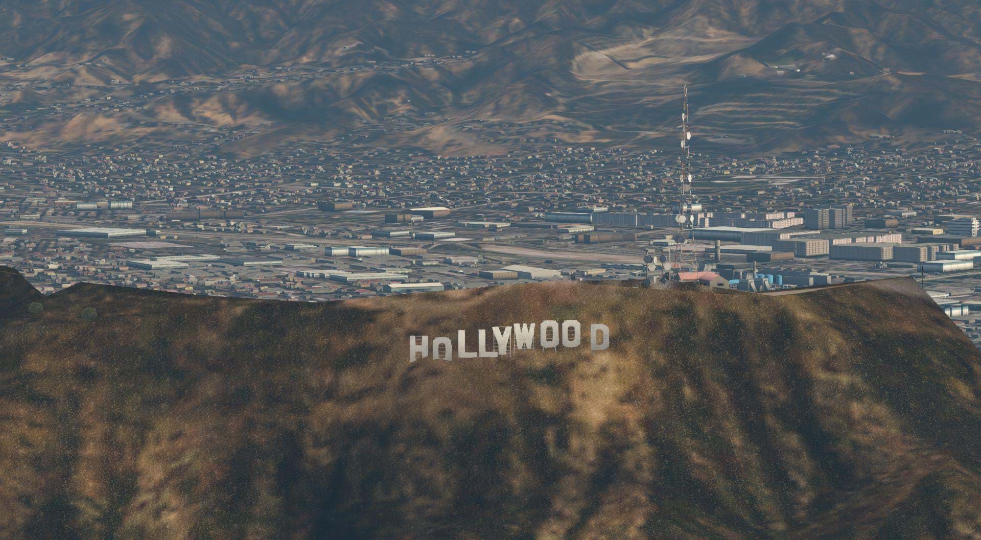
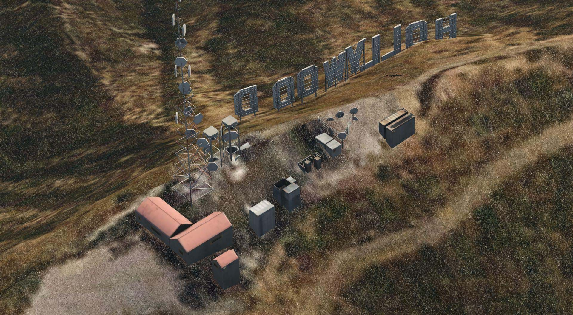
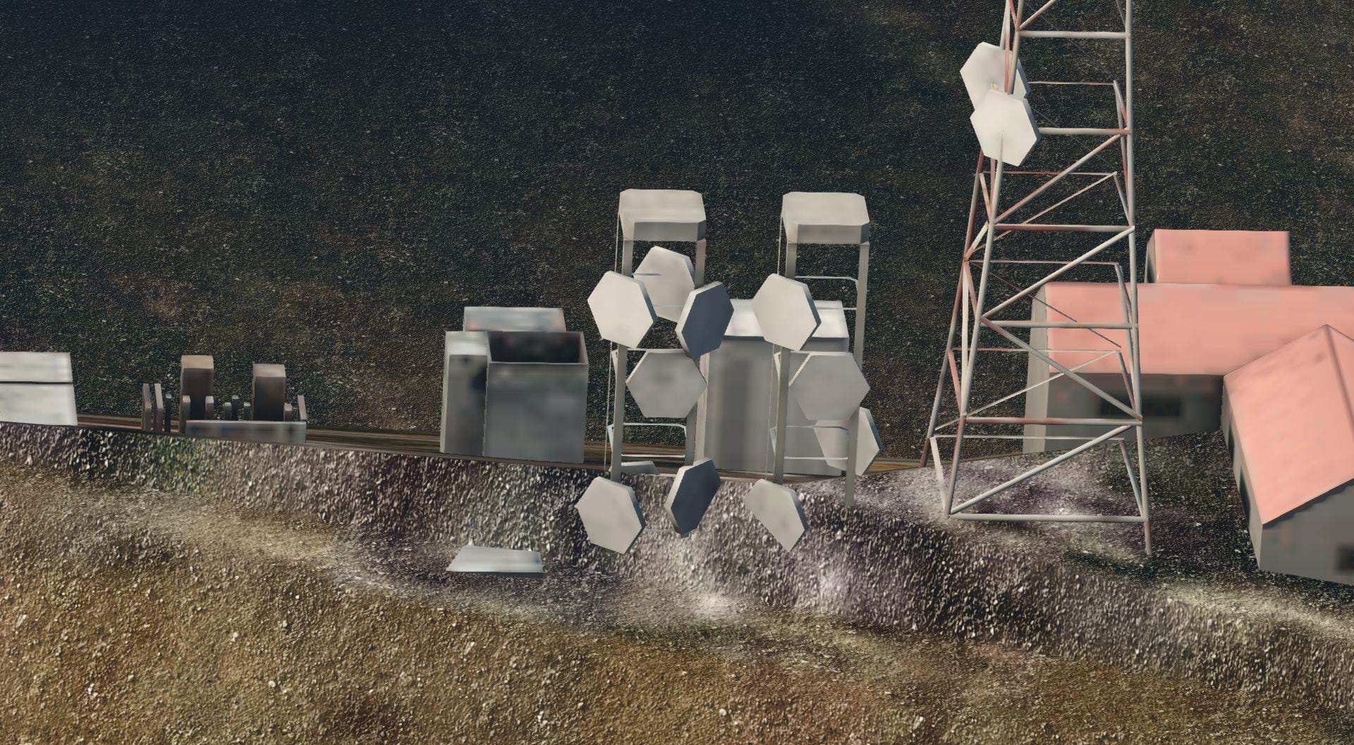
Another issue I had with the terrain mesh was that it tends to eat some of the 3D objects. This is most apparent with some of the landmarks. Two of the best examples of this are the Hollywood sign, and the Griffith Park Observatory, the latter being the worst.
It looks like ORBX did a pretty good job of creating a reasonable model of the observatory, but half of it was gobbled up by the hillside it sits on. There’s a similar situation happening at the Hollywood sign. Part of the sign itself, the H and the O, have been buried into the hillside. The antenna array on top of Mount Lee has been partly obscured by the unflattened terrain mesh.
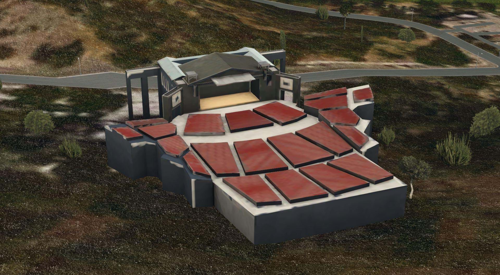
The Greek Theater, and Hollywood Bowl have the opposite problem. These famous amphitheaters are almost entirely above ground, which if you’ve ever been there, you’ll know that there theaters have been built into the natural bowl like terrain features in the hillside, it’s actually part what makes these venues so great.
I suppose it could be considered nit-picky, I could just be happy that these landmarks are present. But these iconic places and all of the floating buildings may speak to a quality control issue at ORBX.
The imagery is high quality, but not as clear as some of the ortho Tiles that I have made myself. The main advantage of the ORBX True Earth scenery is that all of the orthos are color matched so there’s no distinction between one area or tile and another. It’s all smooth and seamless which I really like.
However, there is this weird texturing that ORBX uses for all of their orthos that gives the ground a rocky look. This worked fine in the rural areas, even the desert areas of northern San Bernardino County. But it looks terrible in the city. Residential, commercial and industrial areas seem to be covered in rocks for no apparent reason. Note, there’s A LOT of residential, commercial and industrial areas in southern California! None of this is really an issue at high altitude, which it became apparent that this was the intent.
3D objects
When it comes to the 3D objects in this scenery, I was both impressed, and very disappointed.
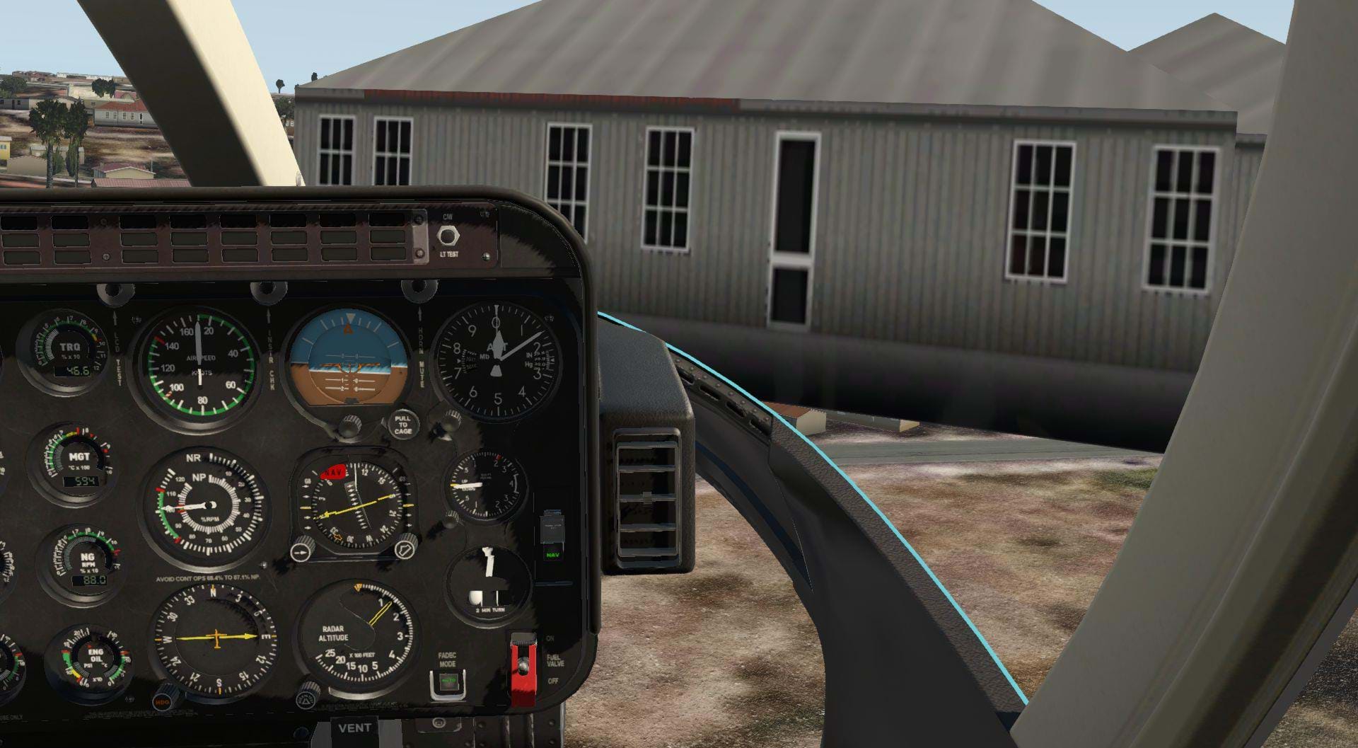
I started exploring this scenery from a very familiar place. Good old Rialto Airport! Well, I should say the area formerly known as Rialto Airport.
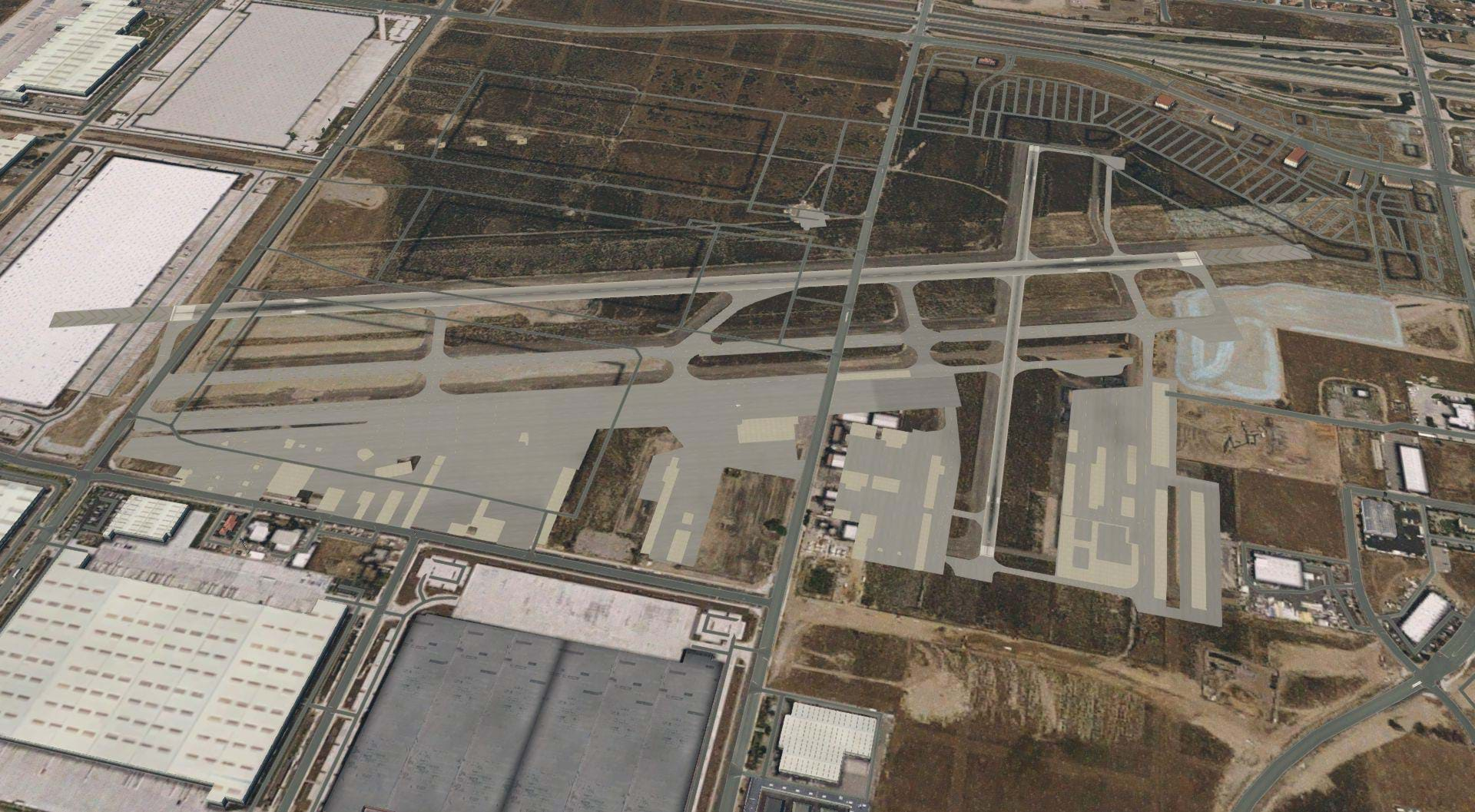
This starting point served two purposes. One pure nostalgia for me. And two, It was a quick way to see how old the imagery they used for their Ortho photos was. In this case, Rialto airport still exists in X-Plane, but closed in real life in 2014. Since then the airport has been consumed buy industrial and commercial areas.
The last time I flew over the area where Rialto airport used to be was February of 2019, what is shown in the ORBX scenery is much different than what is actually on the ground. Today most of the airport itself is completely gone. You can see in the screen shot below the imagery shows the airport mostly intact underneath the X-Plane overlays. You can also that there are roads going across runway 24/06, these roads were built when the new industrial buildings were constructed there where the runway used to be.
So, this tells me that the imagery used here is at least 6 years old, but the roads were updated at some point. Now, I acknowledge that one airport out of the entire southern California area this is a bit of a cherry pick. When rialto closed there wasn’t nearly as big of a media spectacle as there was when Merril C. Meigs was shut down. So, it’s unlikely that any of the ORBX staff would have realized this. Plus, It’s still in X-Plane! So I’m not knocking them for it.
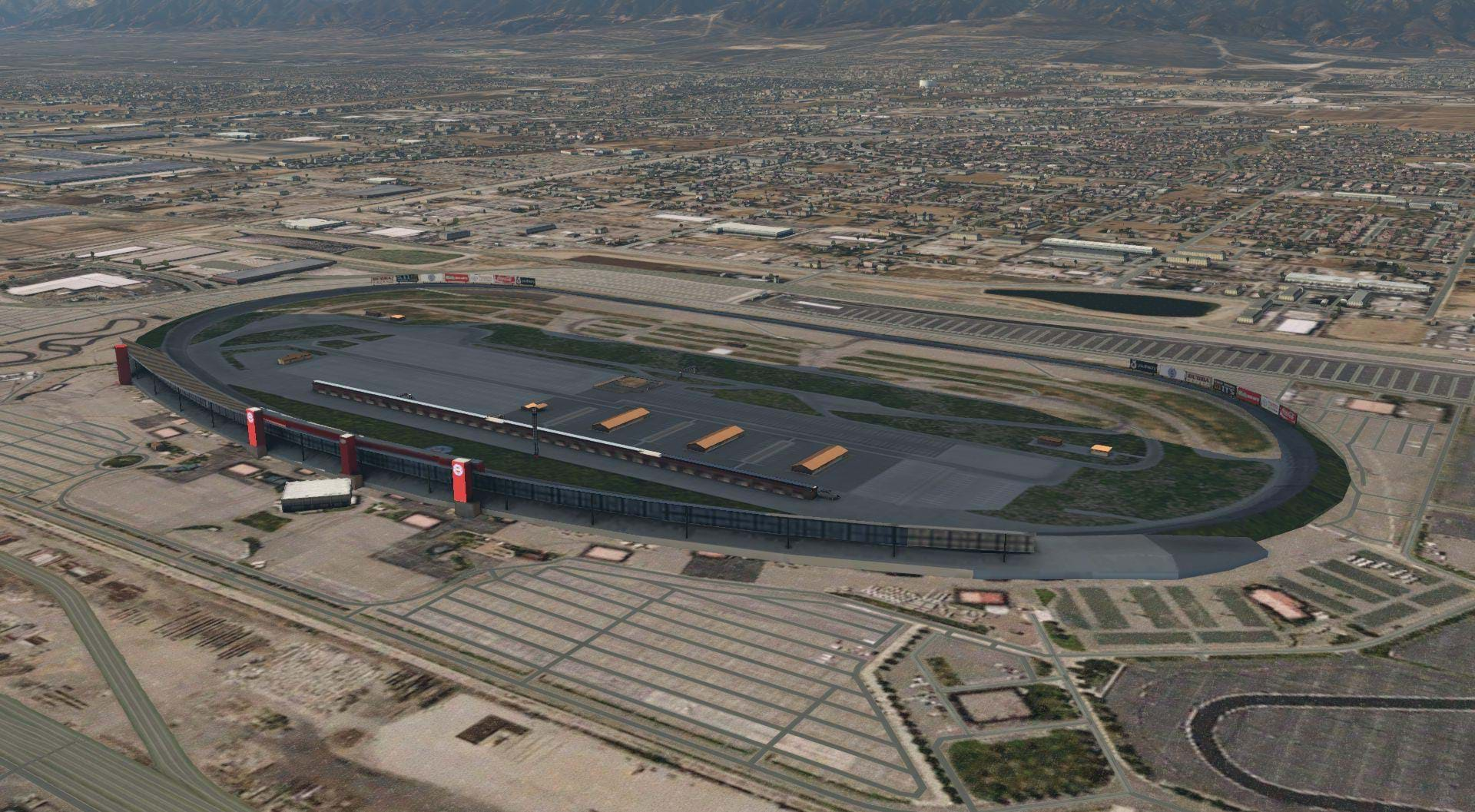
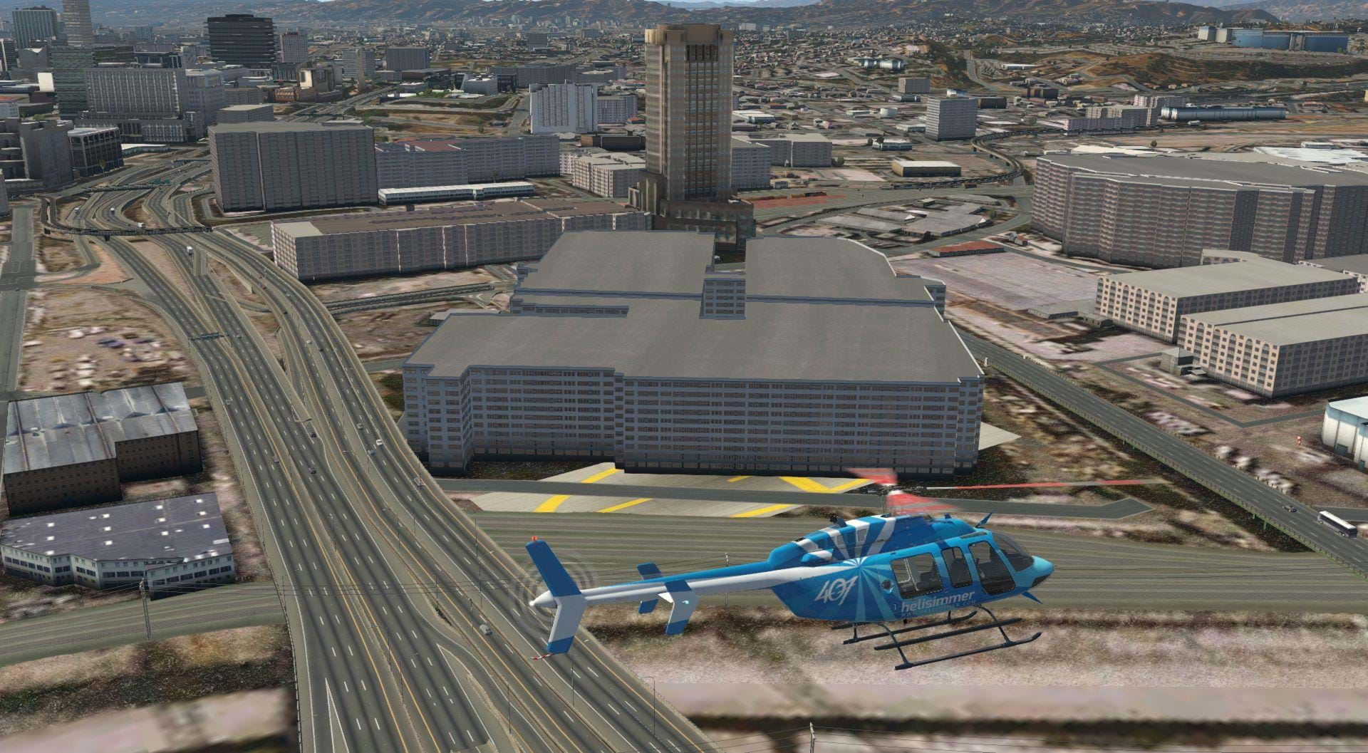
From Rialto I headed west, as I often did when training there. My first checkpoint prior to entering Ontario International Airport (KONT) surface-based class C airspace was the California Speedway. The speedway was right where it was supposed to be, and looked really good.
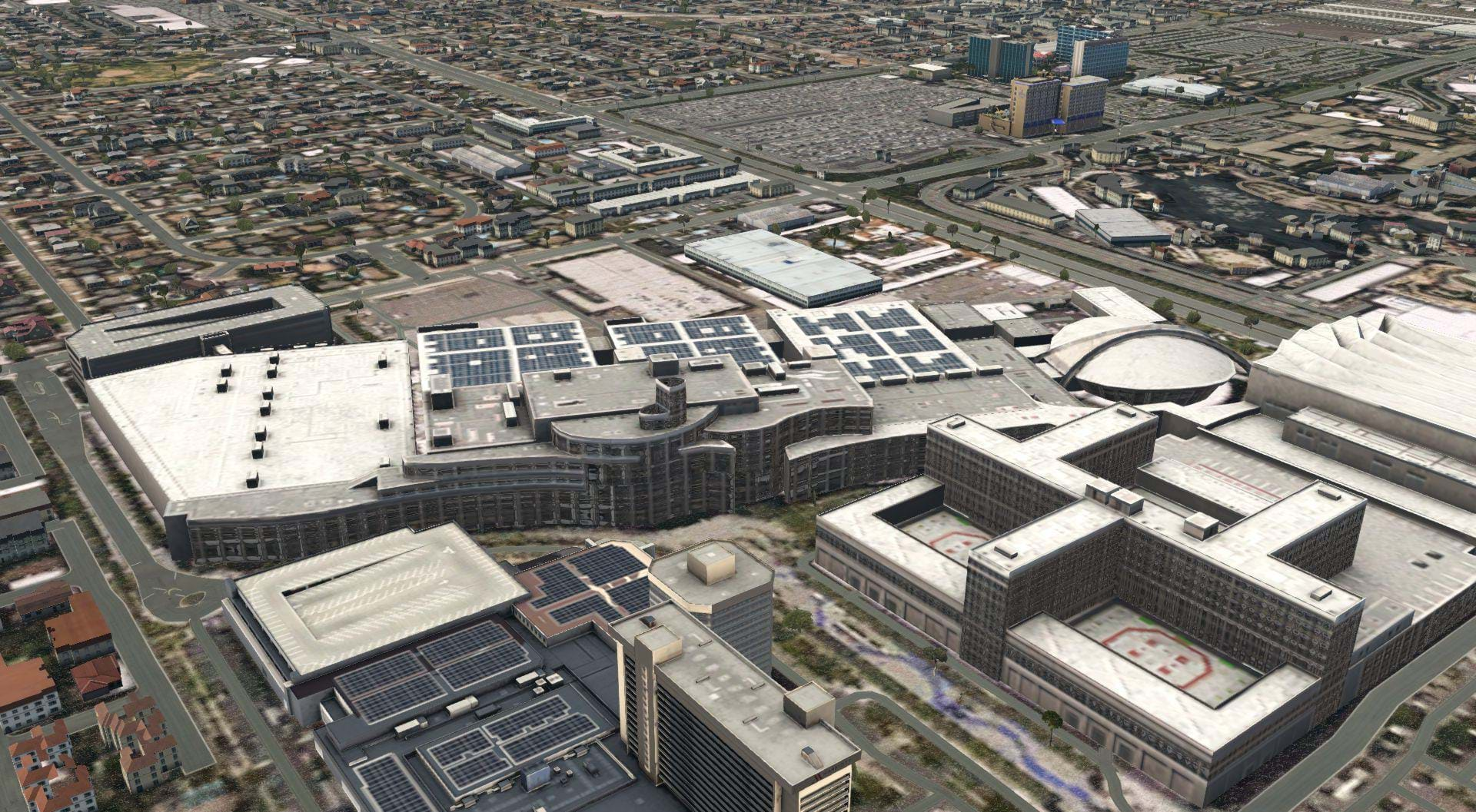
Continuing west, the next stop was the Ontario Mills shopping mall. This mall is really big! It opened in the 90’s and was the largest shopping complex in Southern California at the time. It also serves at a really good VFR checkpoint for an 18 year old kid in a Schweitzer 300C with no GPS! (Me, I’m talking about me).
I was really impressed with the amount of detail that went into depicting the Ontario Mills shopping mall. Like, REALLY impressed! Even though it’s been a few years since I’d been there I spent a lot of time there as a teenager (you know, way back when teens hung out at shopping malls) and recognized a lot of the architecture immediately

Continuing West, we get to Cable airport (KCCB). This airport is only about a 5-10 minute drive from where I grew up. This is where I found my first big anomaly. The Airport and the area about a quarter of a mile around it is raised up on this artificial plateau that absolutely does not exist in real life. But again, this is just one airport out of the entire Southern California area, right? Well, not really,
I found issues near other airports too. For example, Big Bear (L35) and San Diego International had sharply rising terrain about a quarter of a mile away from the airport giving the impression that the flattening of the area was a bit excessive.
Continuing west, past Bracket Airport (KPOC) along the 10 freeway into the City of West Covina I found another landmark that I was both surprised and delighted to see.
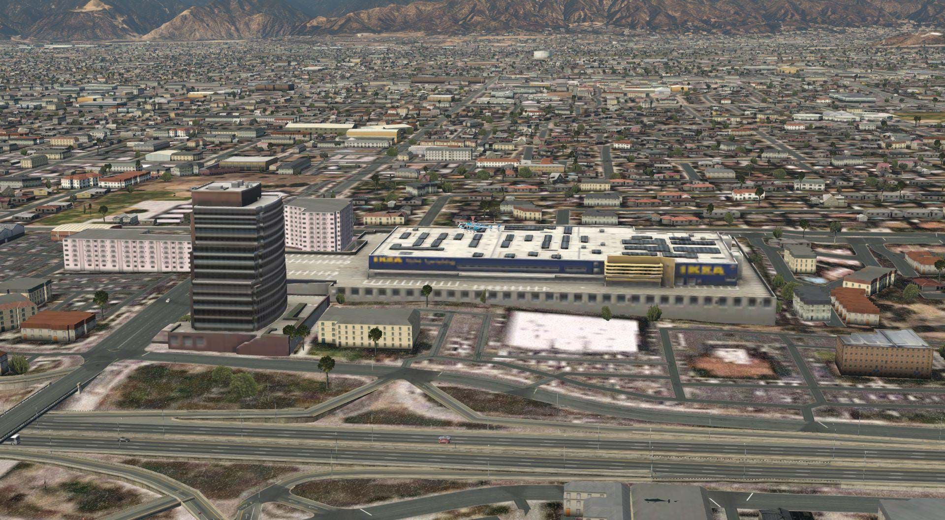
This area along interstate 10 is where I spent a lot of time as a young adult just after high school. I went to a Jr. College not far from here and drove past this building and Ikea every day for about two years! It was pretty cool to see that entire shopping complex so accurately depicted!
Are there helipads?
From here I turned a little bit further to the south, heading towards City of Industry. If they added a random IKEA, they would have certainly added the Financial Center Heliport (40CA) in City of Industry!
Spoiler Alert!!
They did not.

Seeing the heliport as the default X-Plane pad with no other detail, was a disappointment for sure, but it was just one heliport out of all of southern California and a relatively obscure one at that so no surprise that they missed it right? So I turned back to the west, and continued towards Los Angeles.
This is where my heart really sank. As I mentioned earlier, Southern California has a lot of helicopter activity. It’s a mecca of sorts for helicopters. If you can do it in a helicopter, there’s a good chance there’s a helicopter in Southern California doing it.
Flight training, Helicopter Air Ambulance, Charter, tours, Utility, Electronic News Gathering, Law Enforcement, Fire Fighting/Rescue, Film and television, construction and energy are all constantly happening in the Southern California area.
When you count the National Guard and the National training center, you can add Military operations to the list as well. I was extremely disappointed to find that this scenery pretty much ignored or omitted the vast majority of the helicopter infrastructure that helps make this area so interesting to fly a helicopter in.
From 1974 to 2014, any building in Los Angeles taller than 10 stories was required to have a helipad on top, specifically for emergencies. While some buildings already had helipads for business travel or because rich people like to arrive by helicopter, this requirement made roof top rescue from a burning building possible on the entire skyline. This building code created one of, if not the highest concentration of rooftop helipads in the world.
Almost none of them are usable in this scenery.
Now, to be fair, the majority of these helipads were not for public or private use. They were for emergencies, only to be used by rescue and law enforcement helicopters. But there were also a lot of buildings that had helipads for business travel. The local government had helipads on almost all of their buildings. Here’s a partial list of all of the nonemergency helipad in Down town Los Angeles that ORBX could have given us.
CalTrans District 7 (CL31)
Los Angeles City Hall east (59L)
Edward Roybal Federal Building (5CL6)
That’s just a partial list of active helipads and heliports only in down town Los Angeles, there’s more. And of all of these pads, all but LA City Hall East are omitted. But even in the case of City Hall, there’s a pad there that looks like its identical to the one found in the default X-Plane scenery library and it’s 20 feet below the rooftop! This again speaks to a quality control issue.
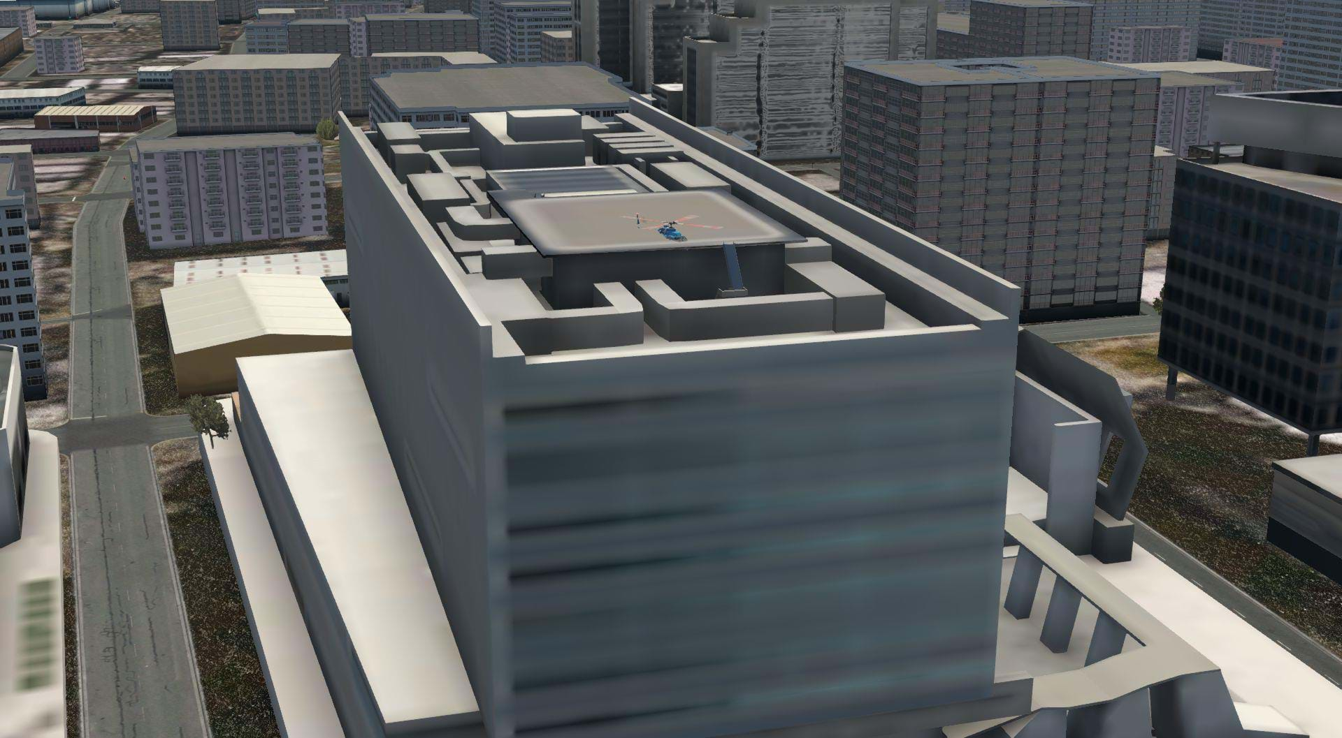
Almost all of the pads are modeled, but they have very low rest texturing and none of them have hard surfaces to land on. And in the case of LAPD’s Jay Stephen Hooper Memorial (58CA), the largest roof top heliport in the world, IT’S NOT EVEN THERE! We got a somewhat random IKEA, but not the largest rooftop heliport in the world?
I thought this might be an object density issue, so I pushed my world objects slider from medium to high, and found that there was a building there where Hooper heliport should be, but it was just a generic building that made no attempt to show the actual Hooper Heliport in any sort of detail. I found the same for the Los Angeles Times Heliport.
This is scenery for a flight simulator, I would imagine that buildings that serve an aviation purpose wouldn’t be omitted.
But Hooper wasn’t the only missing heliport, just the biggest one. If we look at the greater Los Angeles area just north of downtown, the Sunset-Glendale roof top helipad (55CN) is missing in medium settings, replaced with a generic building in high object settings with nothing to land on.
Going further away from downtown to the north you will find that both the Dreamworks Helistop (5CA0) in Glendale and the ABC7-TV helipad (60CL) missing.
Looking south into Long Beach the Catalina sea-air terminal (6CA3) Queen Mary heliport (CL07) are simply not there.
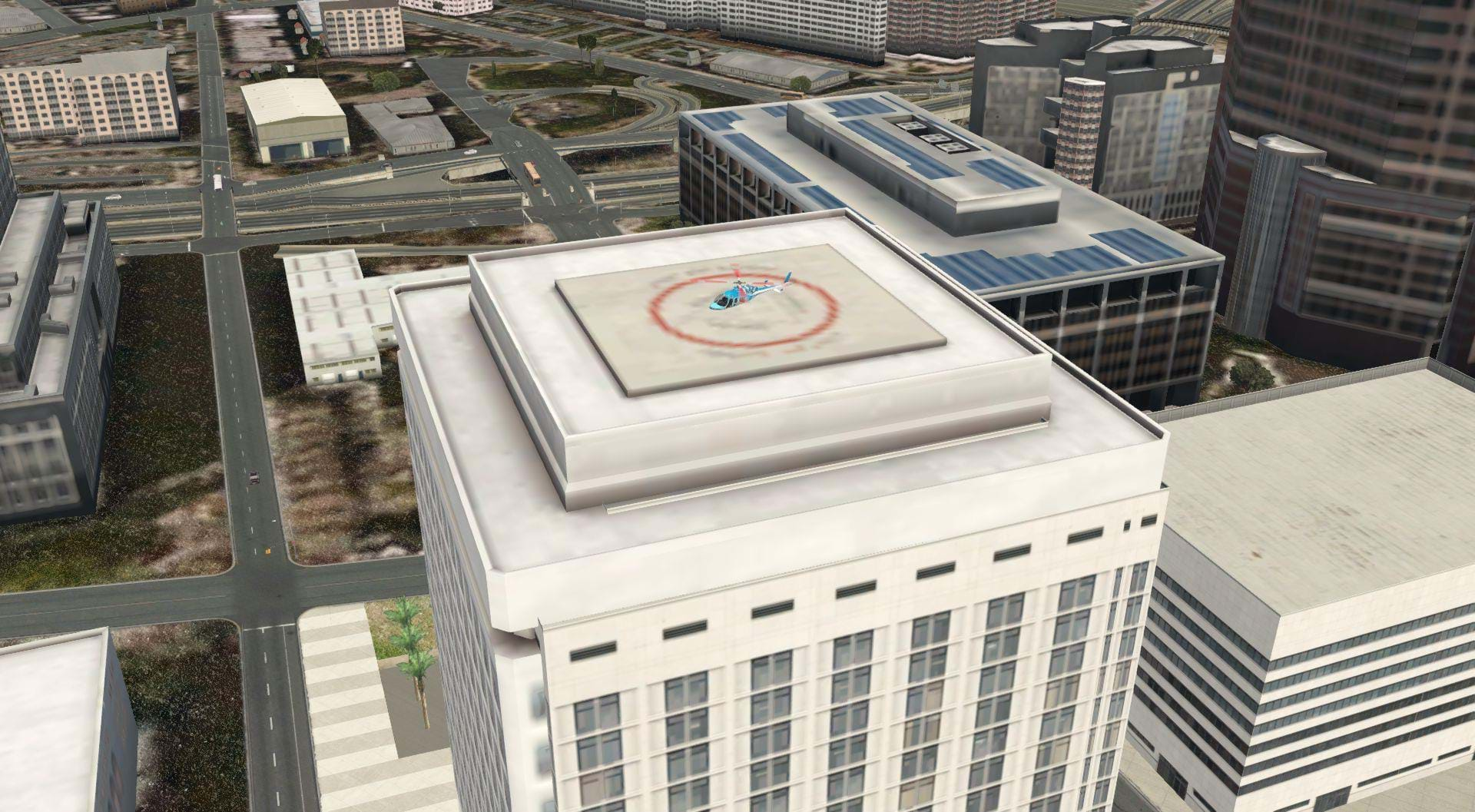
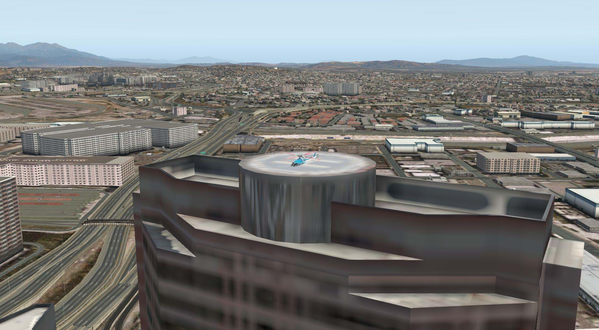
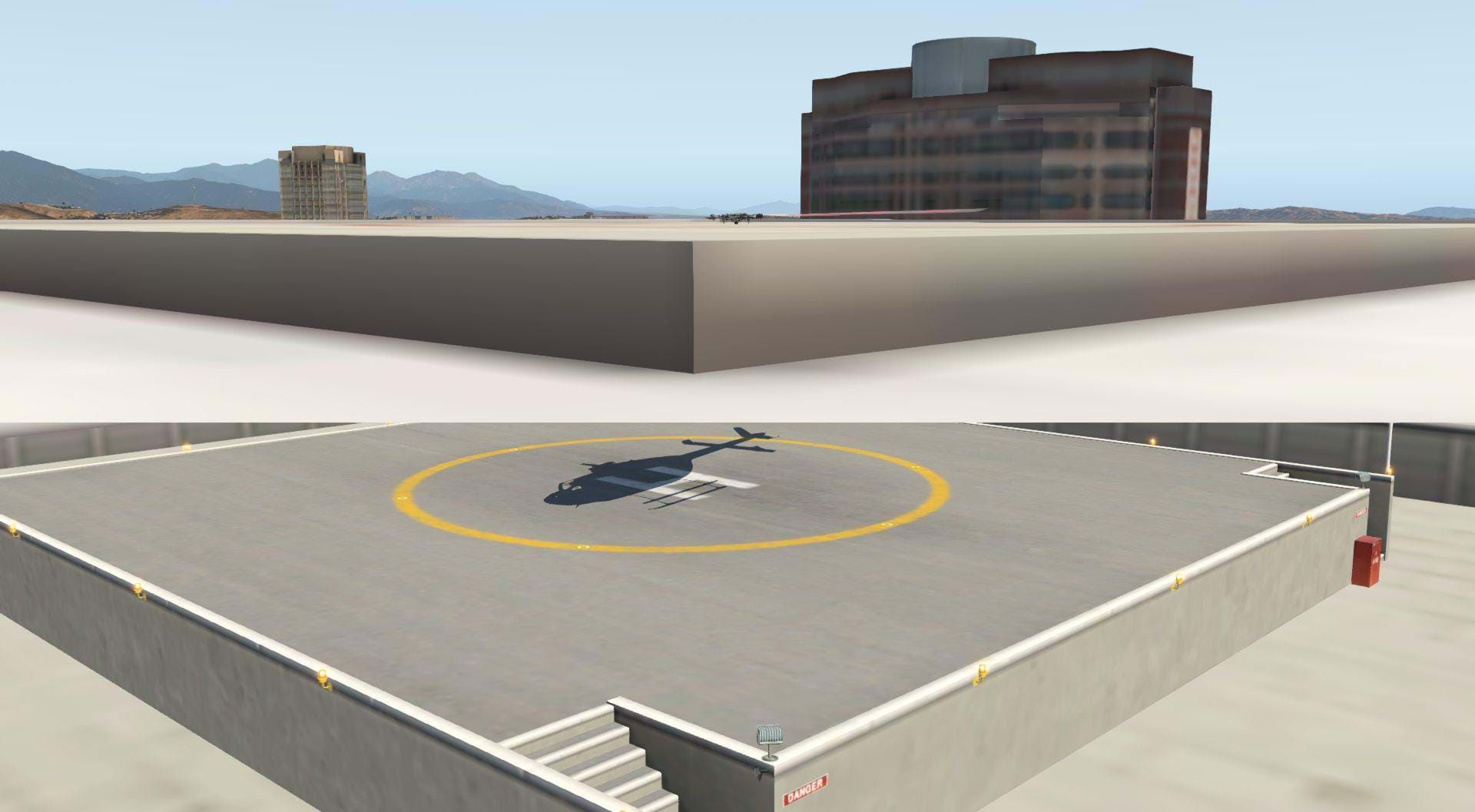
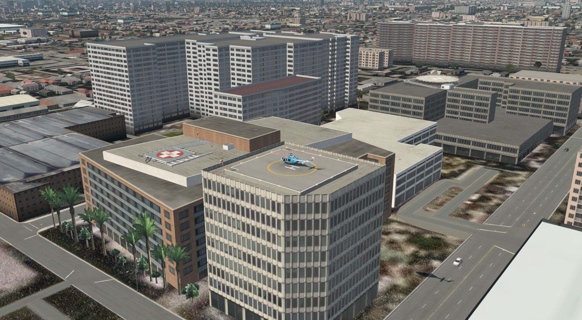
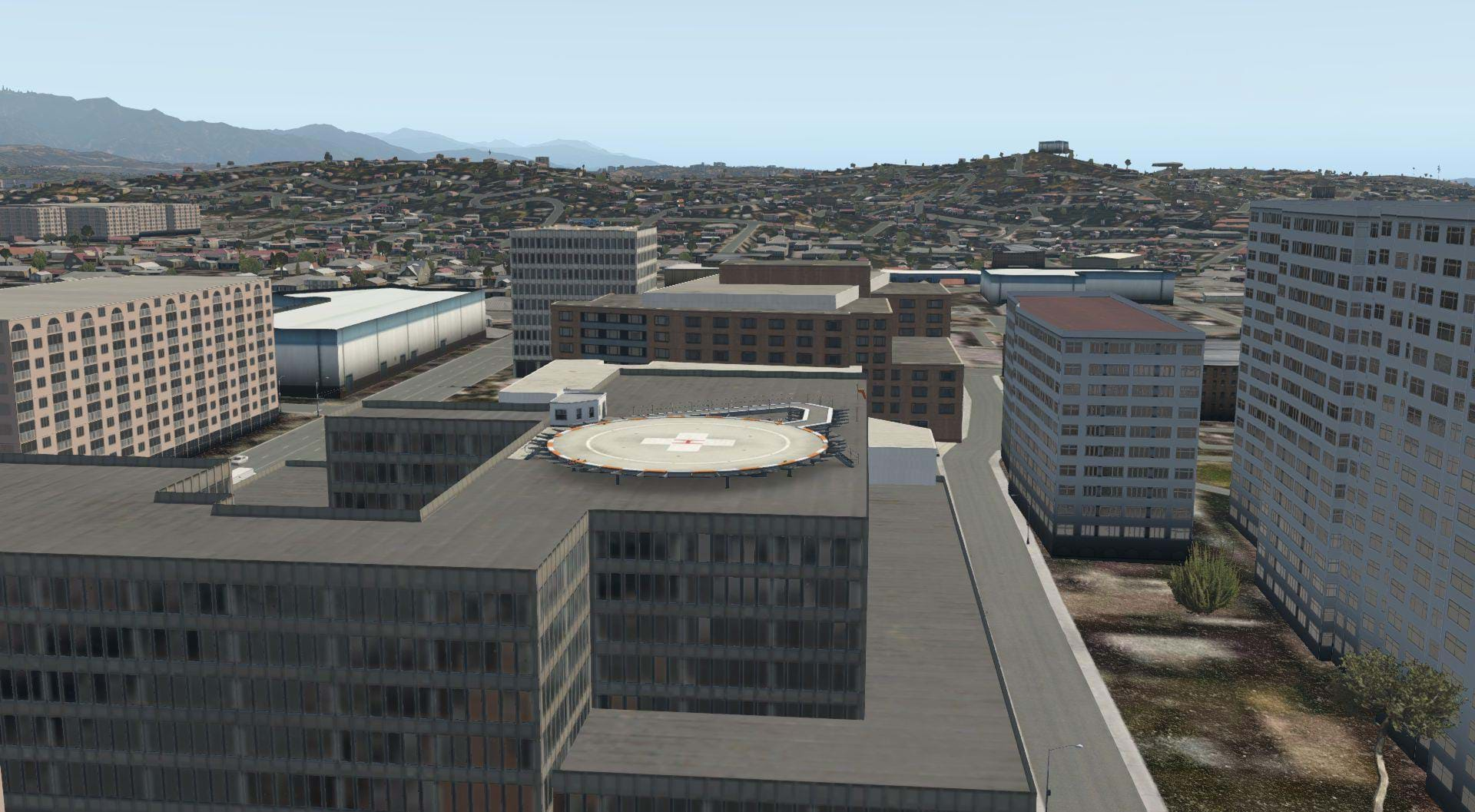
Despite these vacancies, I did find a few helipads on some of the hospitals that were usable, but it wasn’t the best implementation. Instead of making the surface of the 3D model hardened and suitable for landing they pulled a stock hospital helipad from the X-Plane objects library, and plopped it on top of their building. I expected more from payware scenery.
There are some ground-based heliports in this area, but you don’t need ORBX TE Southern California to use them.
They’re the ones that come with X-Plane via the scenery gateway. Two examples are Pebbly Beach (L11) and Pasadena Police Benedict Heliport (3CL4). 3CL4 is actually the identifier for the SuperBowl helipad near the Rose Bowl. X-Plane has Benedict heliport under the wrong identifier for some reason.
The heliports that are there are pretty much in line with the rest of the airports which seem to be the default ones placed on top of the ORBX orthos. I imagine this is to make room for ORBX to sell ported over versions of their FSX SoCal airports. Now, It’s not all bad news. There is one heliport that, as far as I can tell, did improve with this scenery. The Mesa Heliport in Pasadea, just north of the Jet Propulsion Laboratory has been both placed in the correct spot on the hill and flattened!
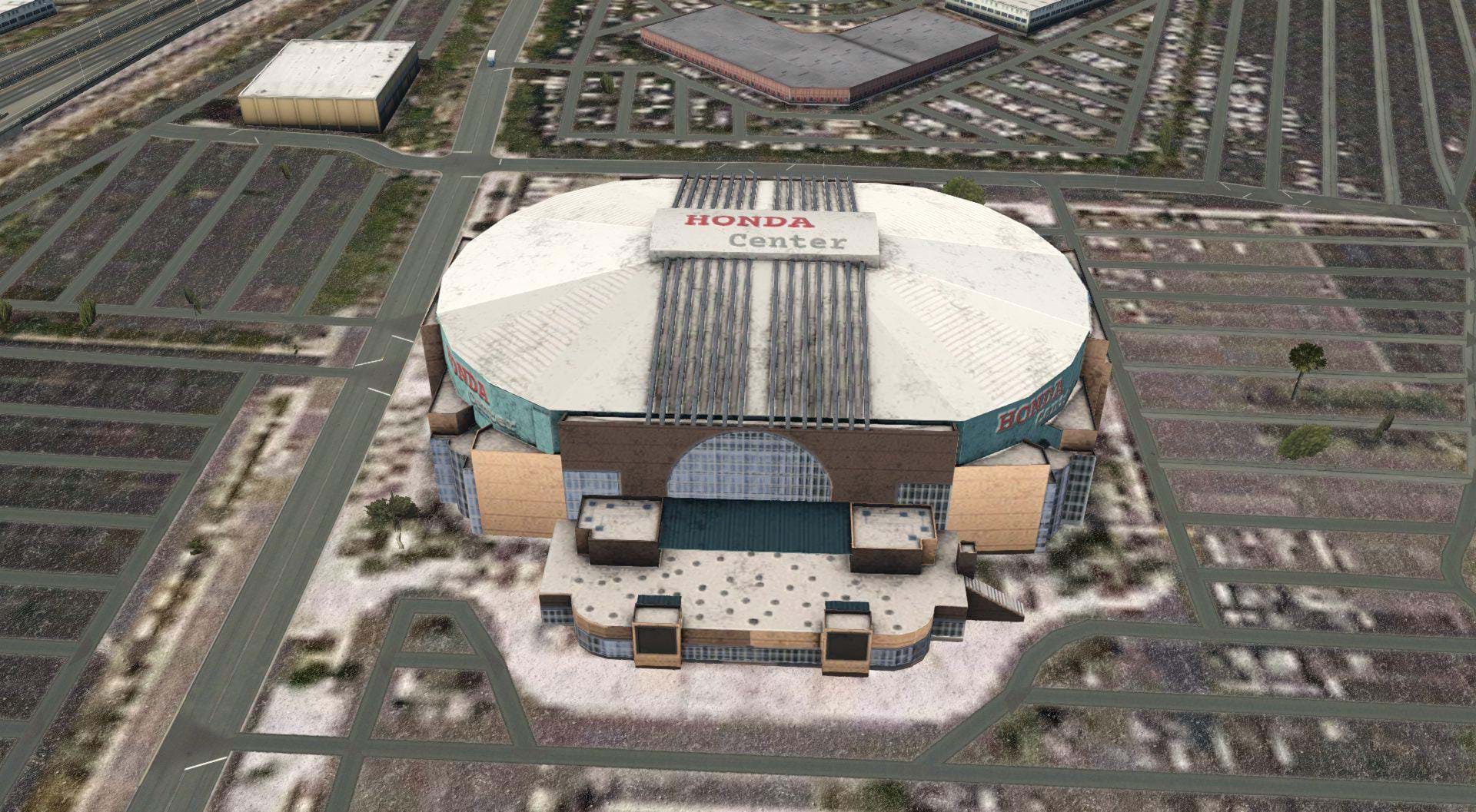
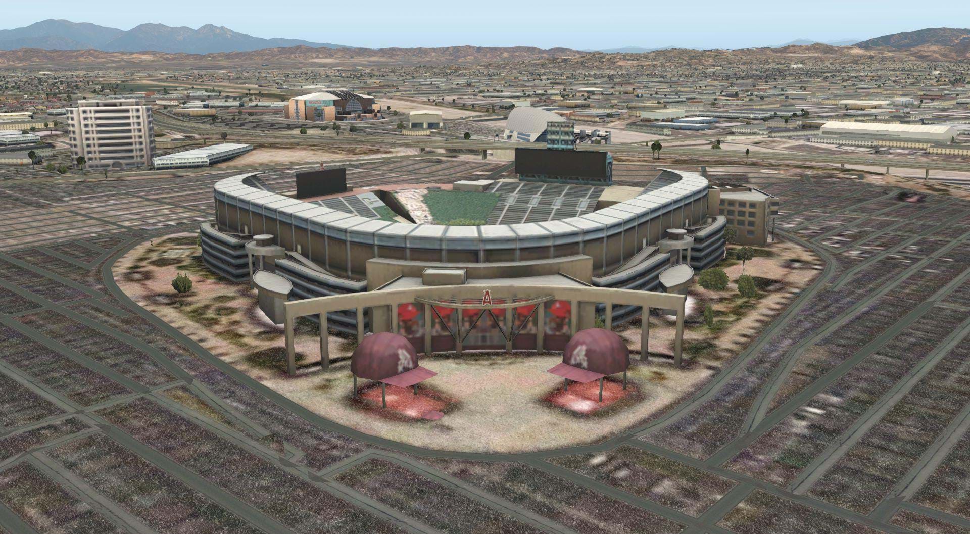
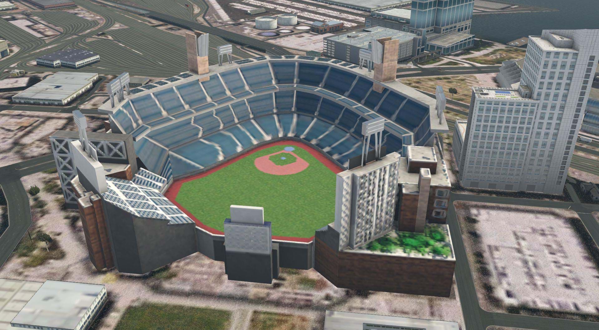
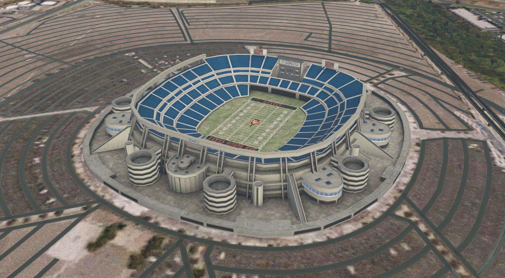
Moving south past Fullerton into Anaheim you’ll find some more local landmarks on display. The Honda Center and Angels Stadiums are both right where they are supposed to be, with an impressive amount of detail. One thing that is curiously left out is the giant A shaped sign in the parking lot of Angels Stadium. But the Stadium its self looks good, complete with giant Anaheim Angels baseball caps welcoming sports fans.
Heading west from the Stadium, you’ll find the Anaheim Convention center. If you don’t remember, this is where the Helicopter Association International HeliExpo was held this year.
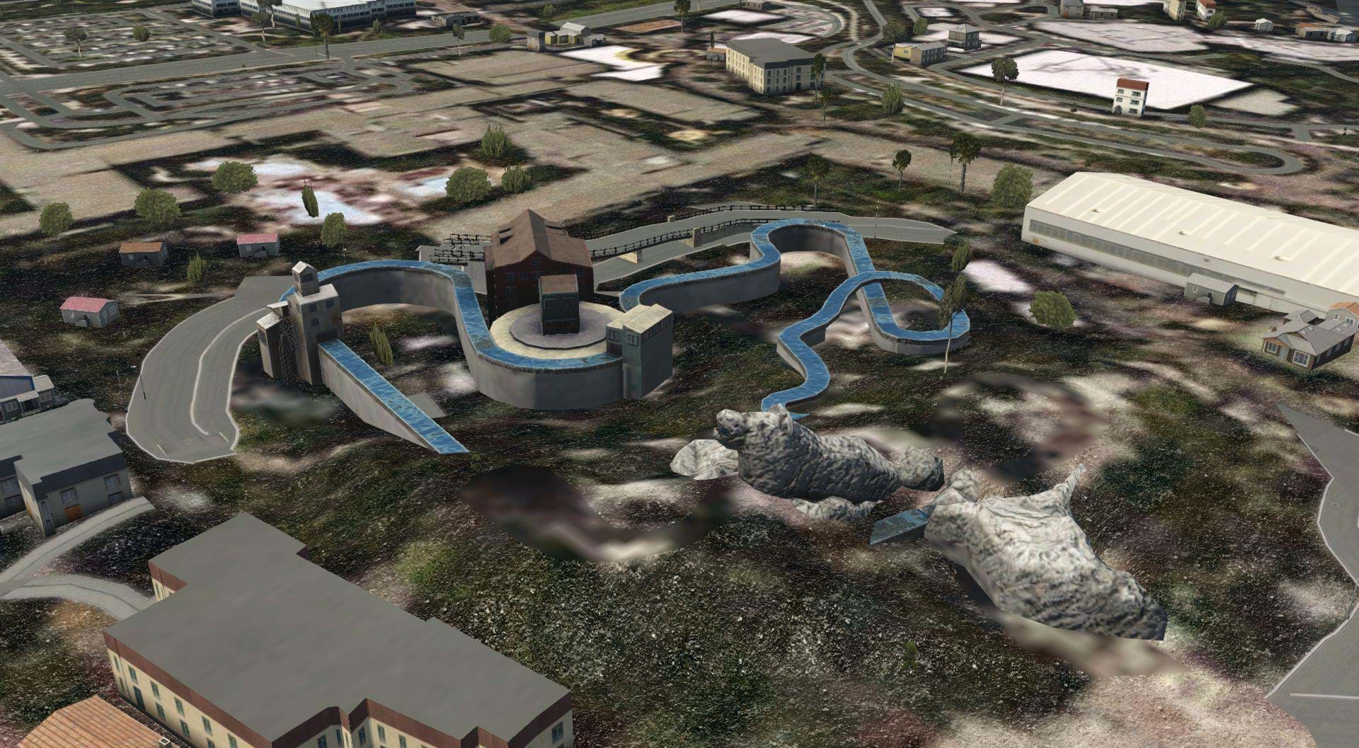
Now, right across the street from the convention center is the world famous Disneyland Theme Park and its younger cousin Disney’s California Adventure Park. With all of the fantastic details in this scenery, Disneyland is virtually unrecognizable.
There’s nothing there that would really tell you it’s arguably the most recognized Theme park in the world. However, there are some bits of California Adventure that can be instantly recognized from over head, in particular the Grizzly River Run attraction.
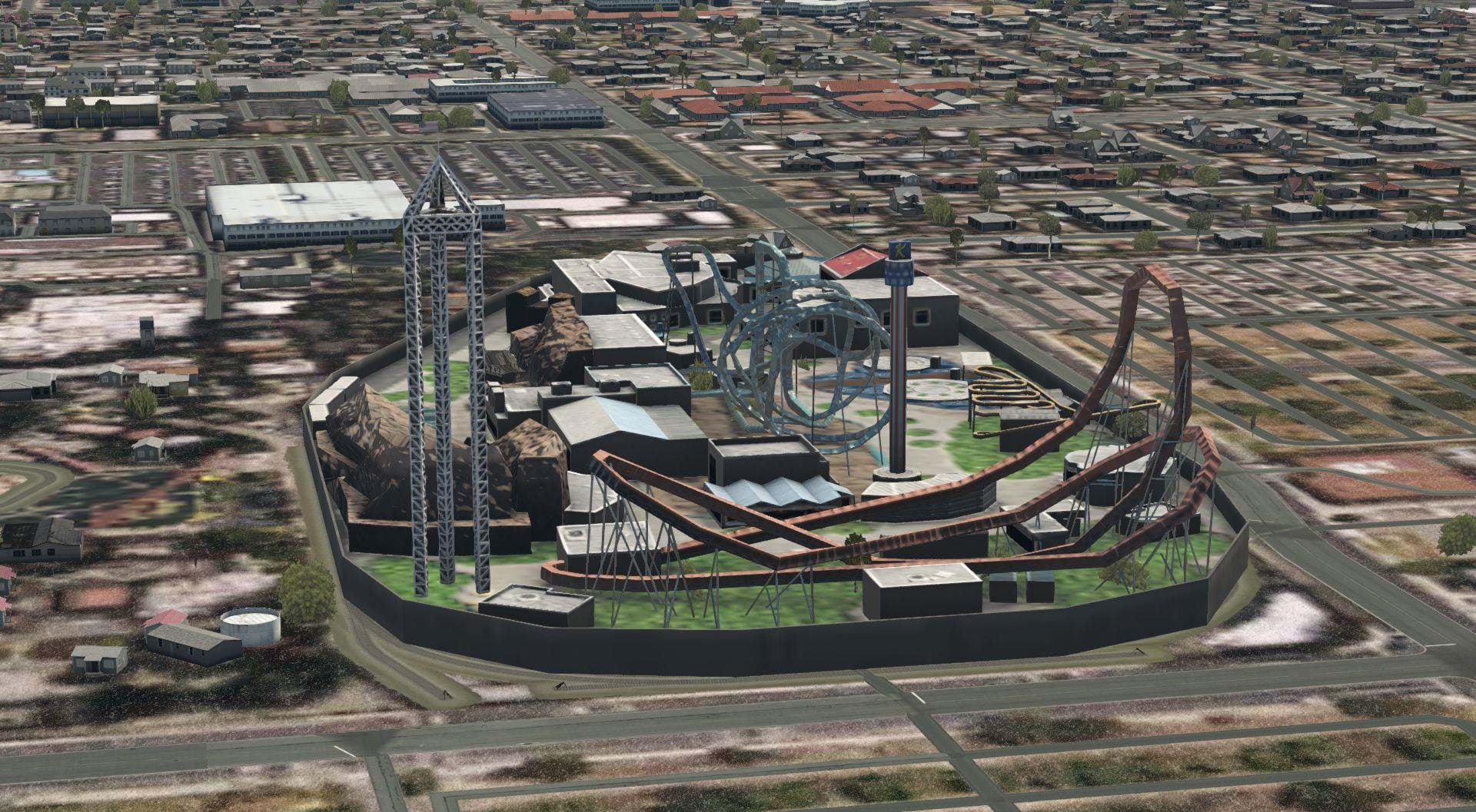
It’s odd that one of the most famous Southern California tourist attractions was virtually ignored in this scenery. In Fact, two other California theme parks got slightly better treatment than Disneyland. Knott’s Berry Farm (not actually a farm anymore) and Six Flags Magic Mountain are both more immediately more recognizable than Disneyland.
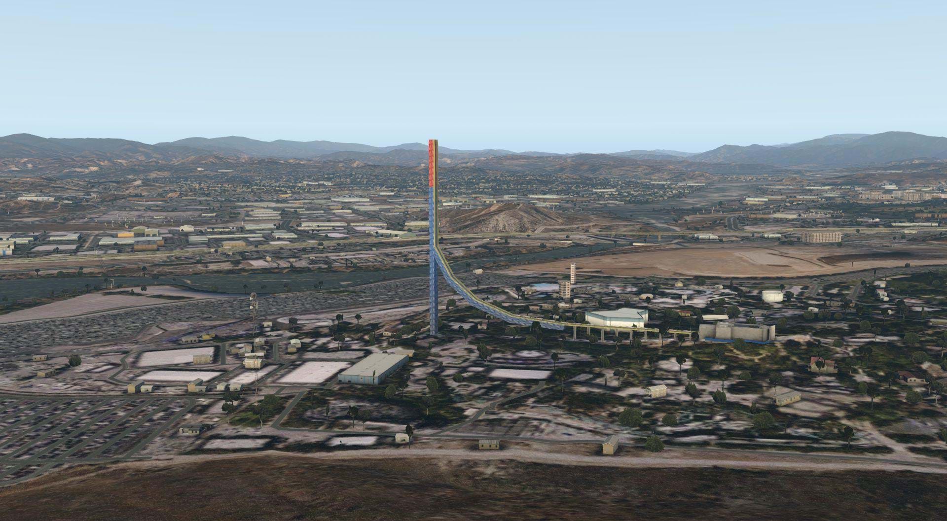
Knott’s three pillar tower, the red white and blue sky cabin tower, and a few of their roller coaster rides are immediately distinguishable. And if your family was on a budget like mine growing up, there was a good chance you spent a lot more time at Knott’s Berry Farm than you did Disneyland. Six Flags Magic Mountain doesn’t have the details of Knott’s, but the Towering Superman Ride can be seen from Miles away.
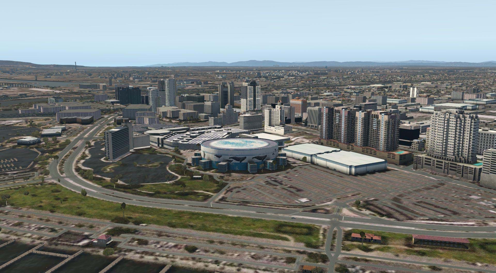
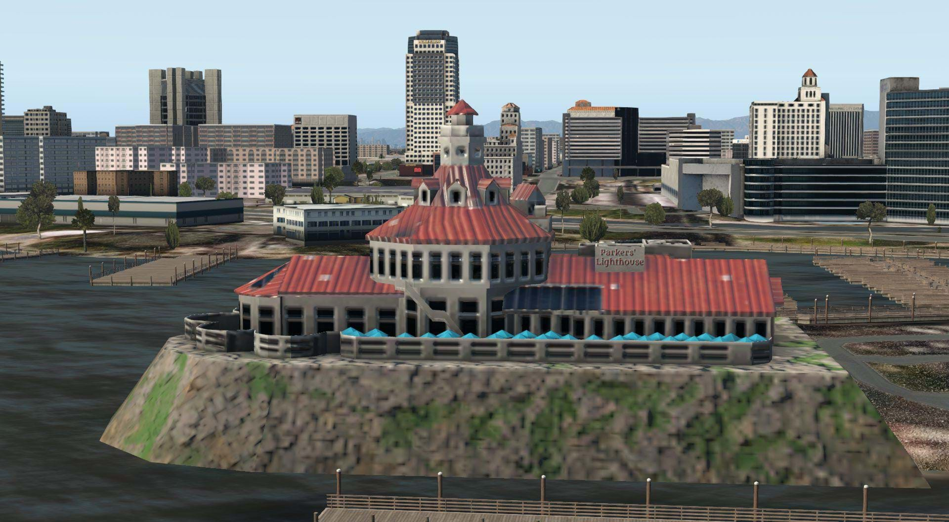
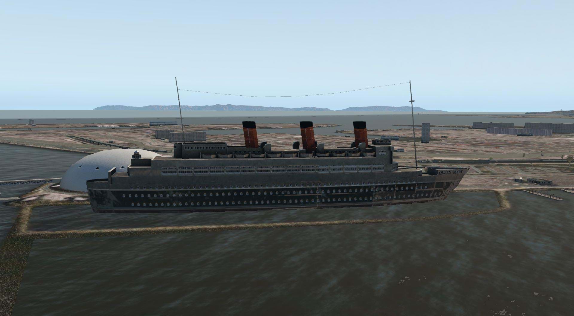
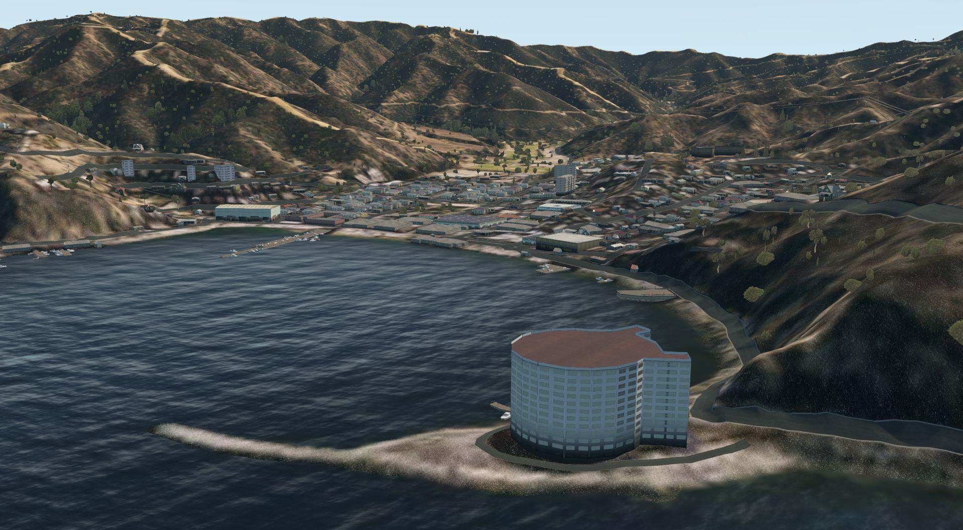
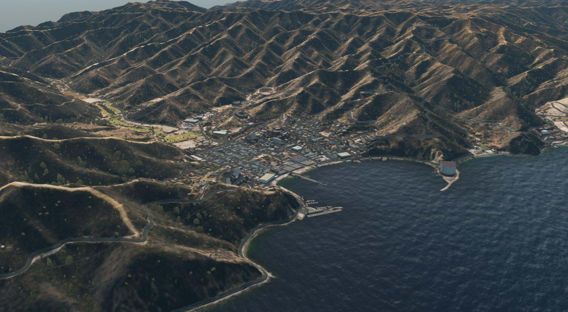
On the Coast on the West side of Long Beach you’ll find the Marina. The Long Beach Aquarium of the pacific is conspicuously missing, but the Long Beach Convention center and the surrounding hotels are immediately recognizable. Parkers Light House restaurant (their mahi mahi is pretty good) Is present in the amount of detail I wish the heliports in this area had. Queen Mary, a historic and magnificent luxury liner turned hotel sits proudly in the harbor, but as I mentioned before, you won’t find the Queen Mary heliport (CL07).
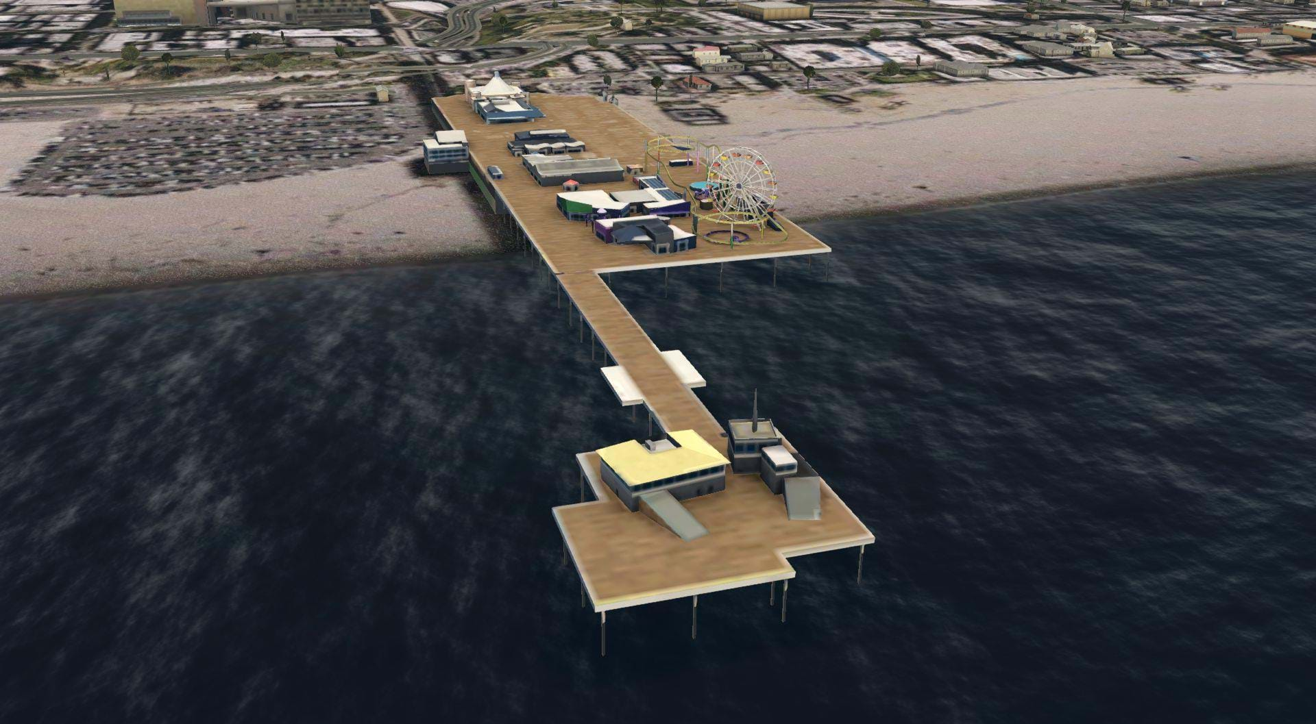
Heading north along the coast, just past LAX, you’ll find the historic Santa Monica pier in good detail.
Of Course, Southern California is more than just three counties and heliports right? This scenery covers a lot of area, too much to show all of it, and I’ll admit, I haven’t had time to explore it all, but there are some highlights that might be interesting to some folks who aren’t all that concerned with non functional helipads and just like flying over beautiful scenery.
San Diego has a good showing here in this scenery pack. I last flew a helicopter IRL in San Diego about a year ago, everything looked familiar.
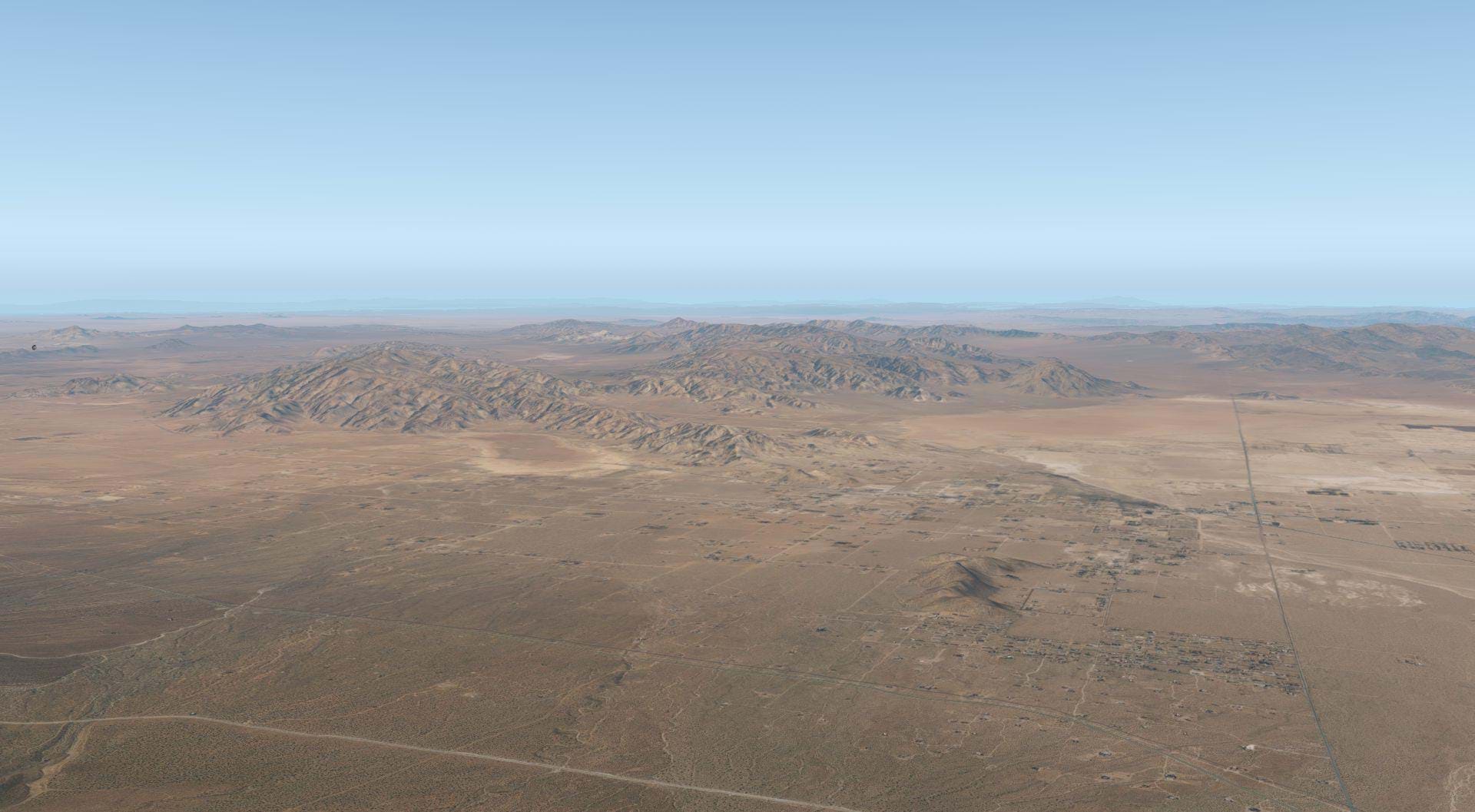
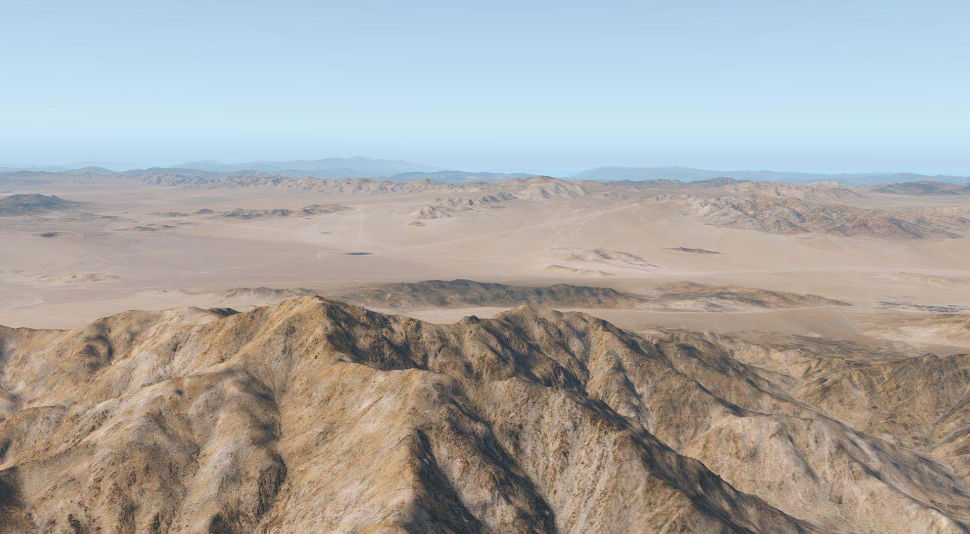
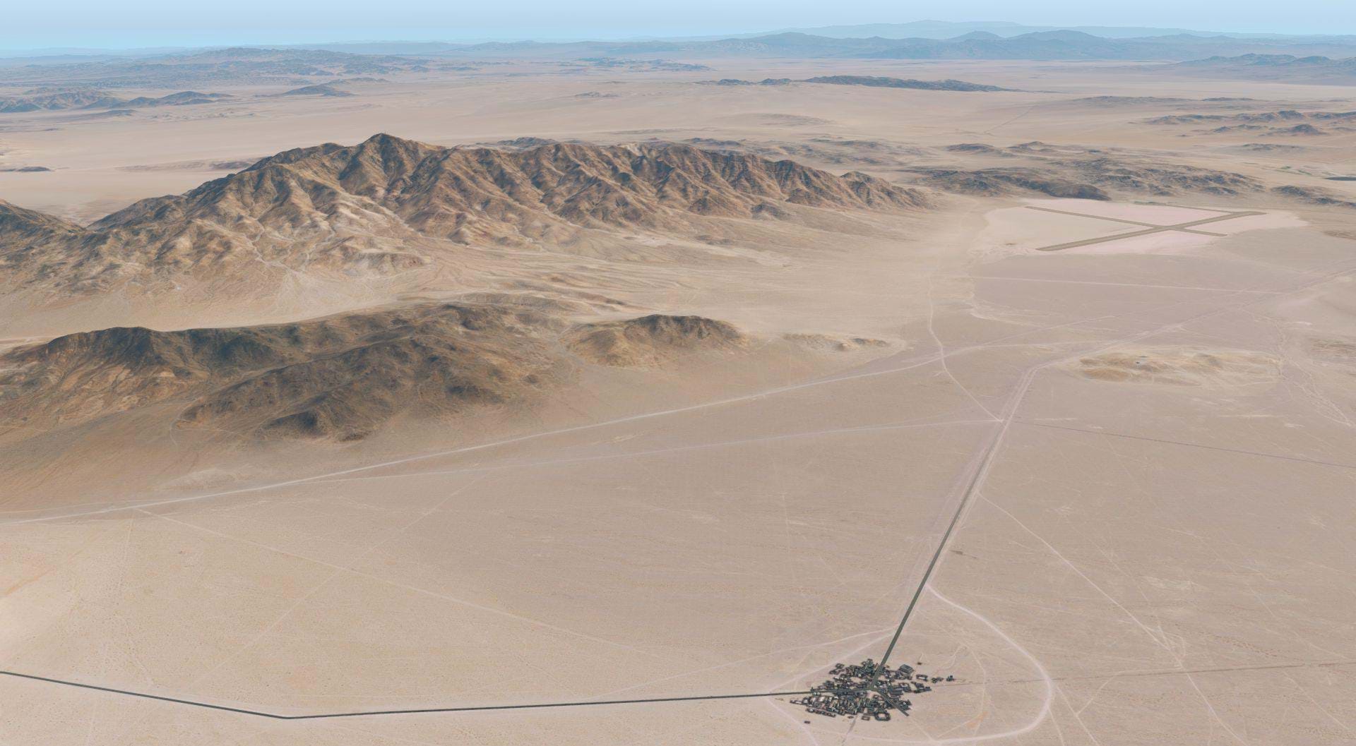
Even though there isn’t much in the high desert, this area looks really good
If you recognize this place, you probably have “fond” memories of Atropia.
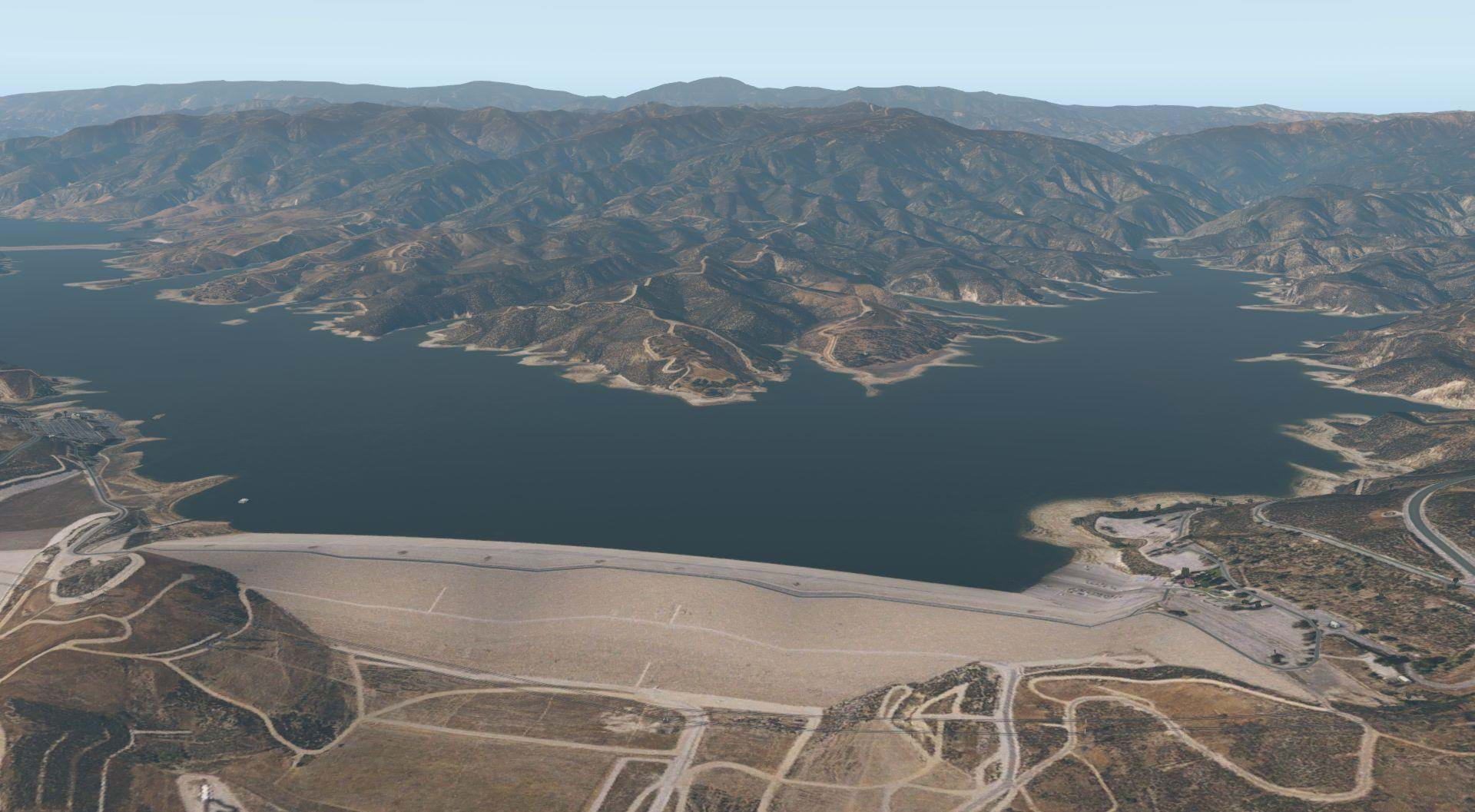
Castaic Lake looks ok. The scenery mesh doesn’t quite get the dam right, but the area looks good otherwise.
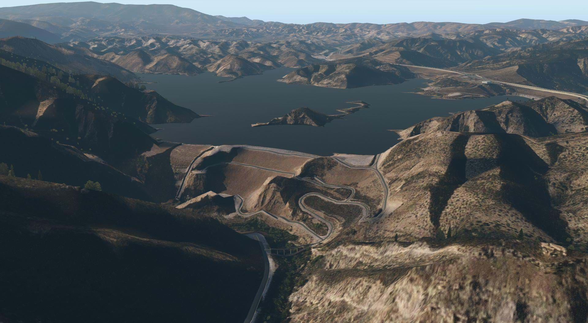
The dam at Pyramid Lake looks a little better.
Hisperia looks quite nice, and captures the transition from desert to mountains really well.
Big Bear Lake

San Bernardino national forest and Mount San Gorgornio
Catalina Island looks good. With all of the details this scenery has, I felt the treatment of the islands iconic Casino was a bit of a copout. Instead of showcasing the beautiful architecture of that unique building they replaced it with a seemingly generic one that only appears when the world objects are set to high.
There are boats in the Harbor, but they all seem to be literally on or in the piers and boat docks, not next to them. This seems like an oversight.
Performance
As always, when it comes to FPS, results may vary.
My set up is as follows
- I9 9900K
- 32GB RAM
- RTX2080
- Oculus Rift-S
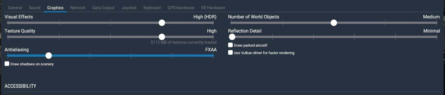
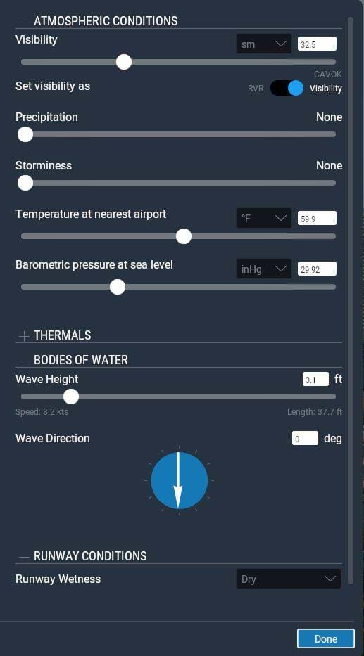
For the majority of this review, these were my graphics and weather settings.
Without VR, I get FPS in the mid to high 90’s sometimes even as high as 110fps in some areas like the mountains and high desert. Near downtown LA, that dropped to the mid 70’s peaking at about 80FPS. Cutting that in half for VR, I was able to maintain a solid 40 FPS with those settings.
Kicking up the World Objects to high brought my FPS down to about 25-30 FPS over the city. The closer I got to LAX however, the worse my frame rate got, dropping as low as 25FPS near Santa Monica. I had virtually no FPS impact in the San Diego area.
Most of my initial testing was done in the DreamFoil Bell 407, but it should be noted that I got different FPS in other models. In the freeware MD500, I gained about 10 to 15 FPS over the city and in the desert the gains were even larger peeking at a solid 80 FPS in VR! So there’s a very wide range of frame rates that you’ll experience with this scenery.
I tested this in both Open GL and Vulkan. At the time of this writing the current Beta version of X-Plane is 11.50b6. Even though I was able to maintain better FPS in Vulkan, OpenGL gave me more clear textures. Everything was very blurry in Vulkan, which is probably due to the amount of VRAM on my GPU.