Frank’s previous work includes the huge and amazing Dolomiti 3D, which we reviewed some time ago. Dolomiti 3D is a true masterpiece and heaven for the VFR fans out there – especially helicopter pilots.
When I heard Mr. Dainese had teamed up with Fabio Bellini and was working on a new project, I couldn’t be anything short of excited to see what was coming up.
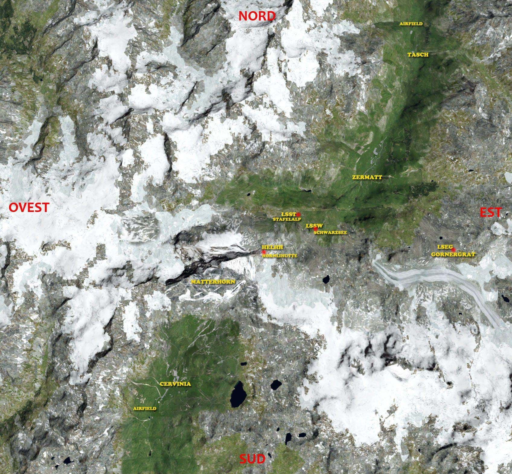
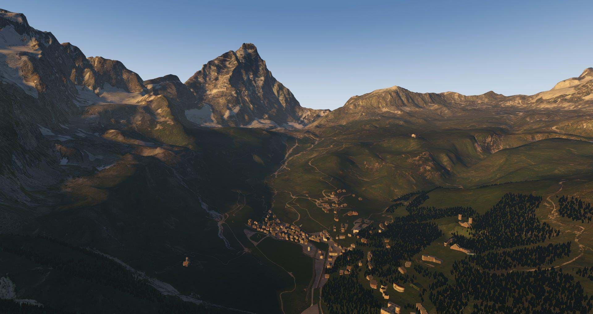
The region covered this time would be an area of 500 square kilometers (a bit short of 200 square miles) at and around the Matterhorn, one of the Alps’ highest mountains at over 14,500 feet (nearly 4,500 meters) high and situated at the border between Italy and Switzerland.
The region is rather similar to Dolomiti, although is rather far from it (about 330Km / 200mi to the West).
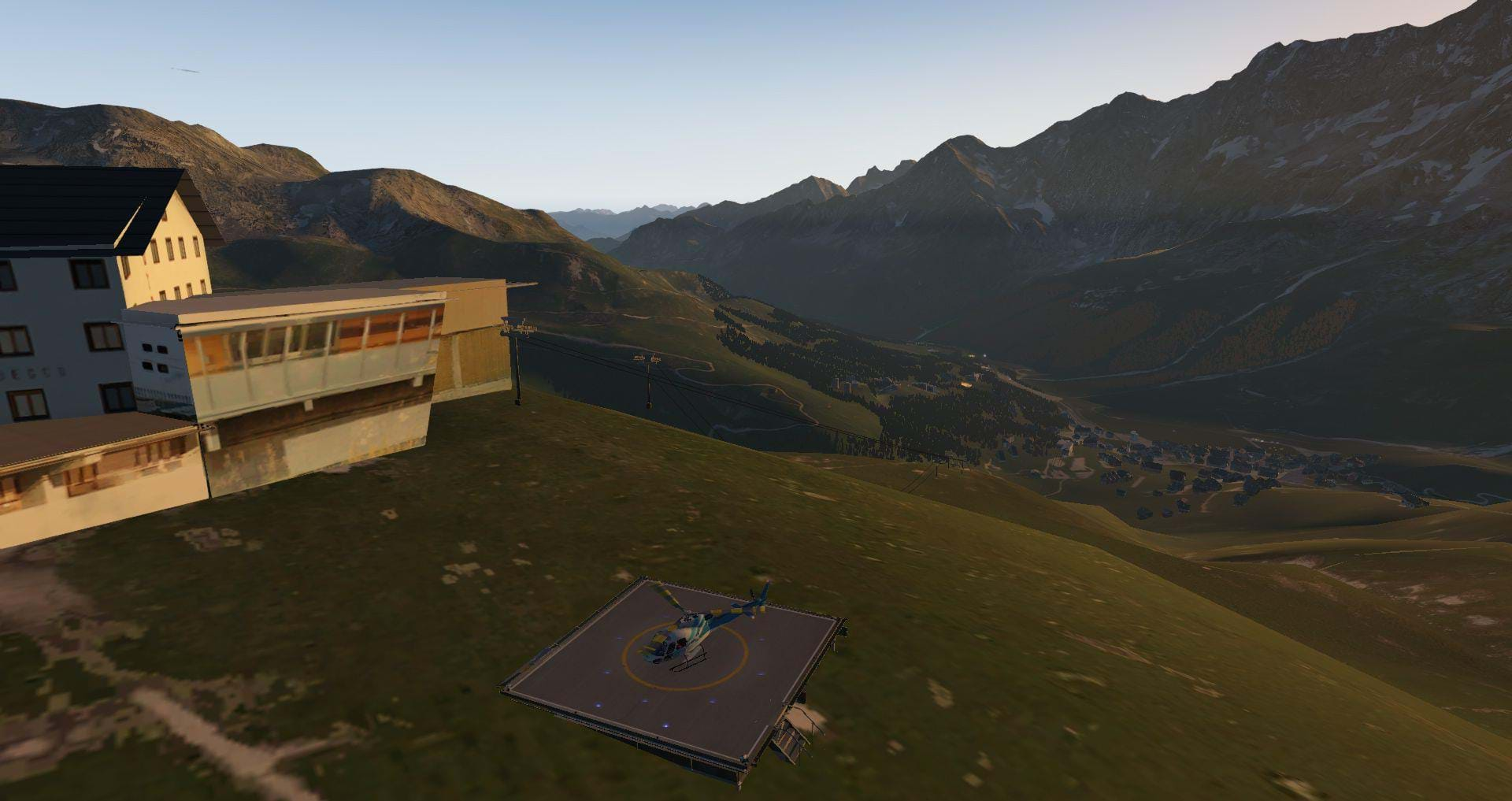
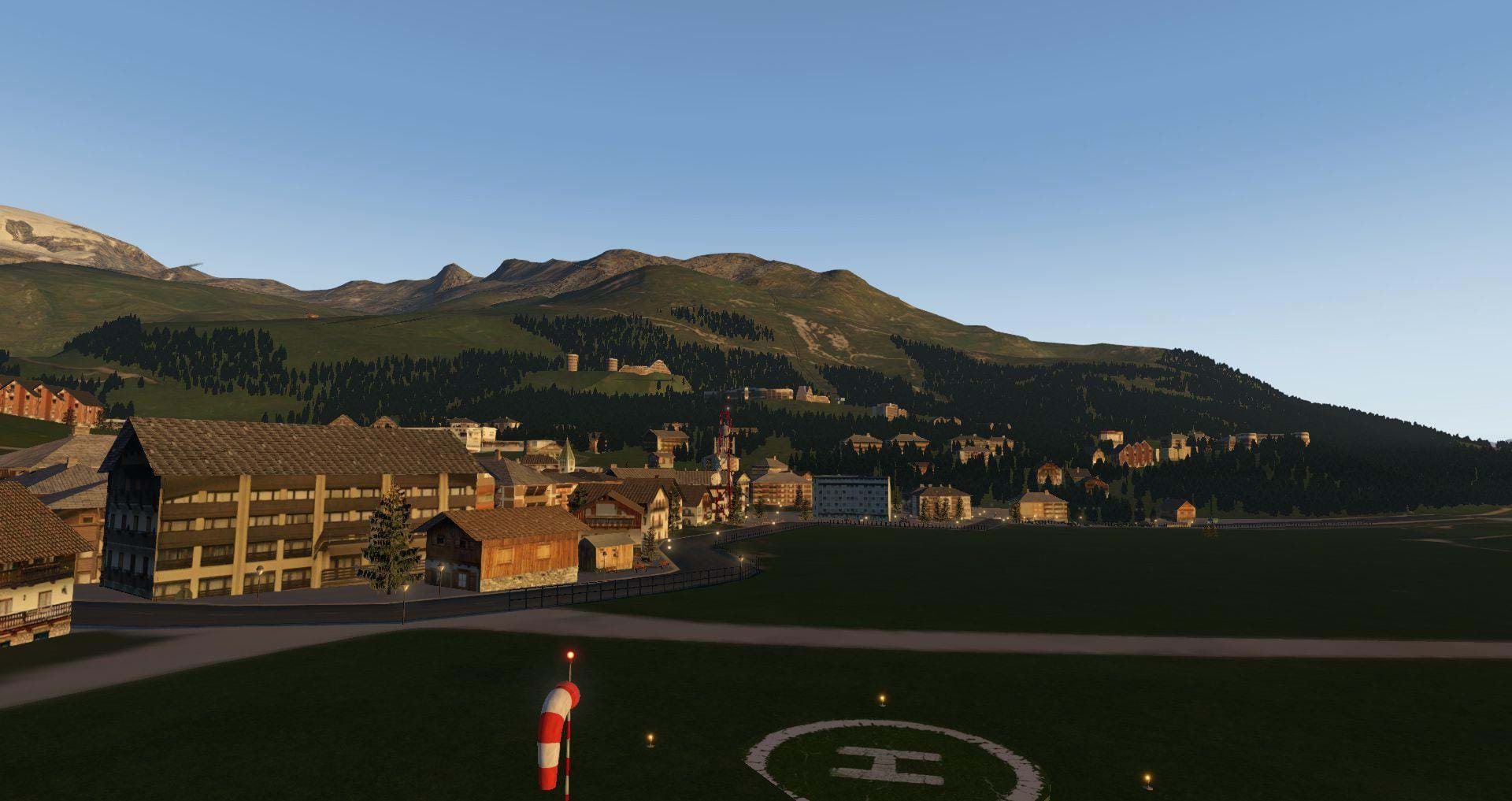
Being in the Alps makes it, obviously a scenery rich in mountains and valleys with a lot of small villages scattered around, which makes it a wonderful place for VFR flights, with lots of scenic routes.
The manual clearly indicates this as the scenery was developed with VFR in mind: “This scenery is exclusively suitable for VFR flight, only with "visual flight" it is possible to take full advantage of the characteristics of the scenery.”
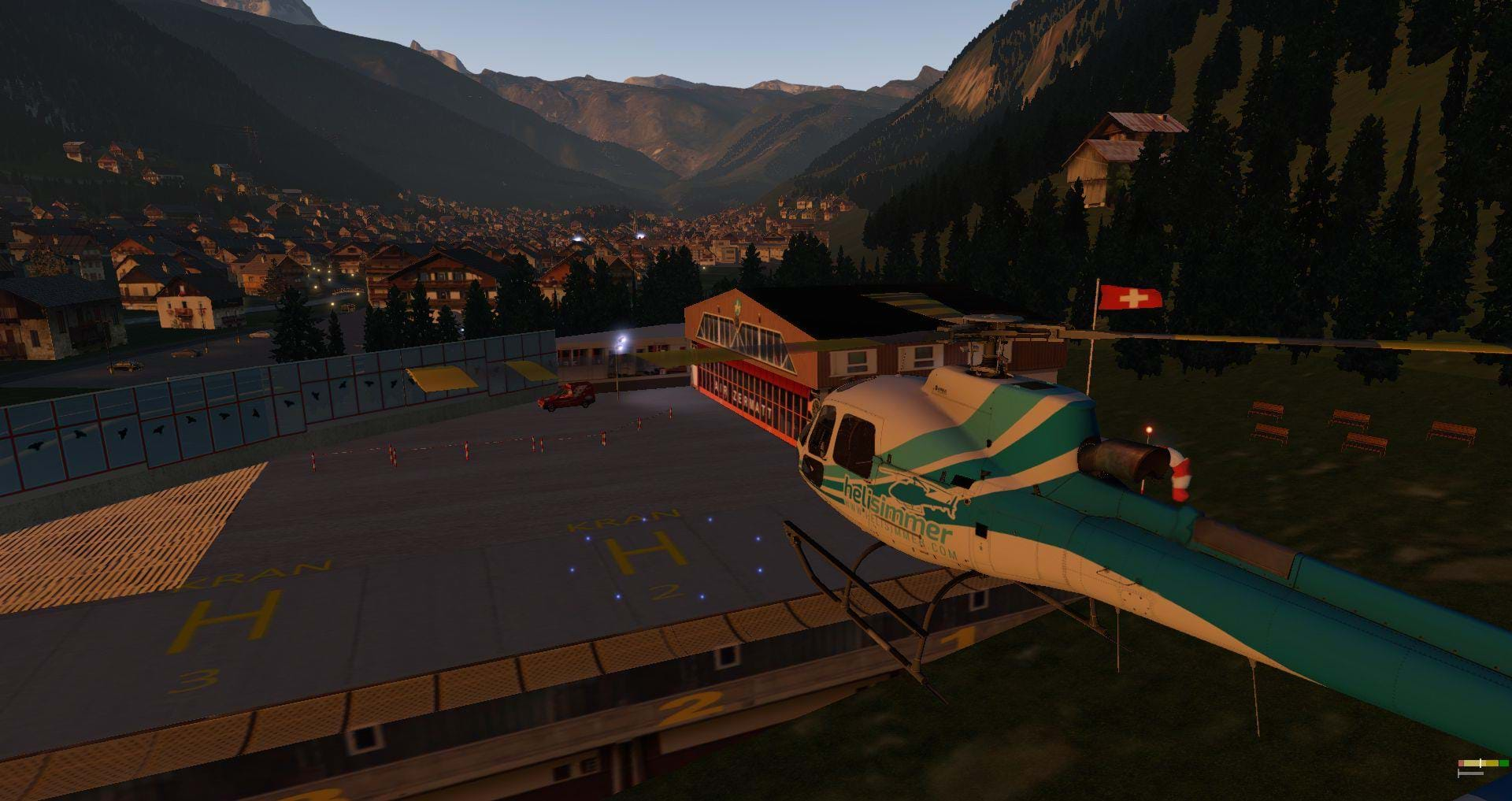
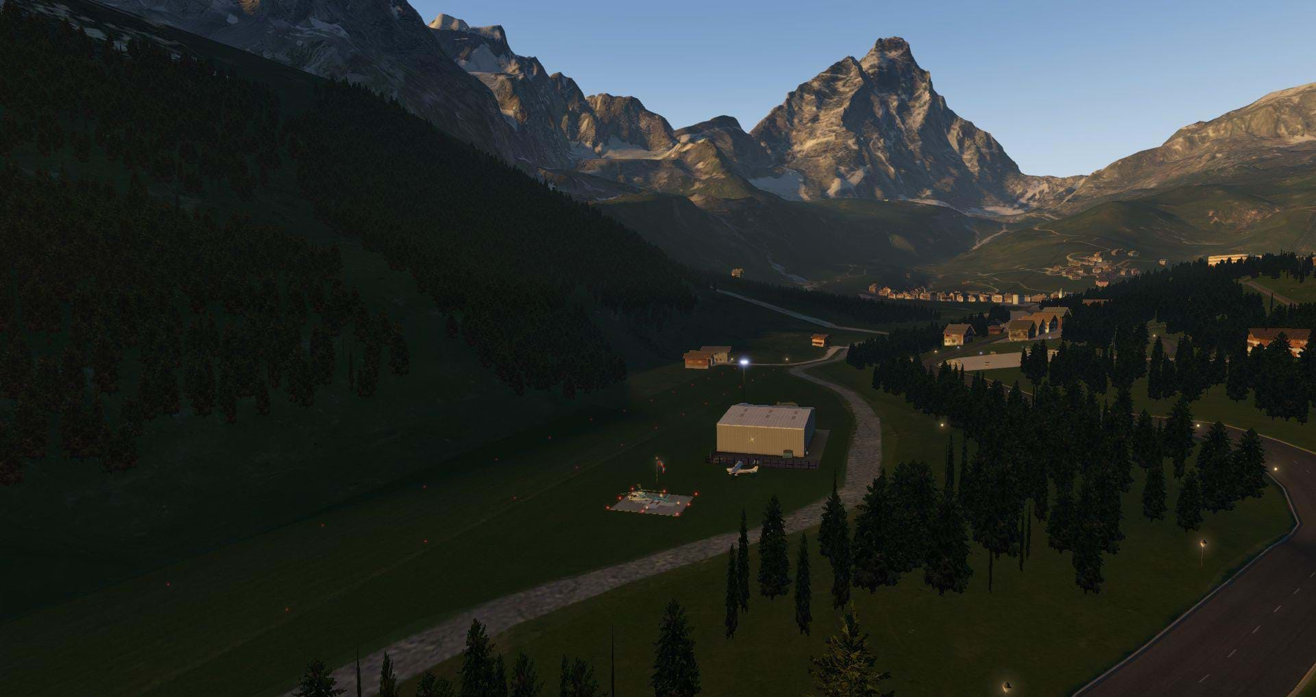
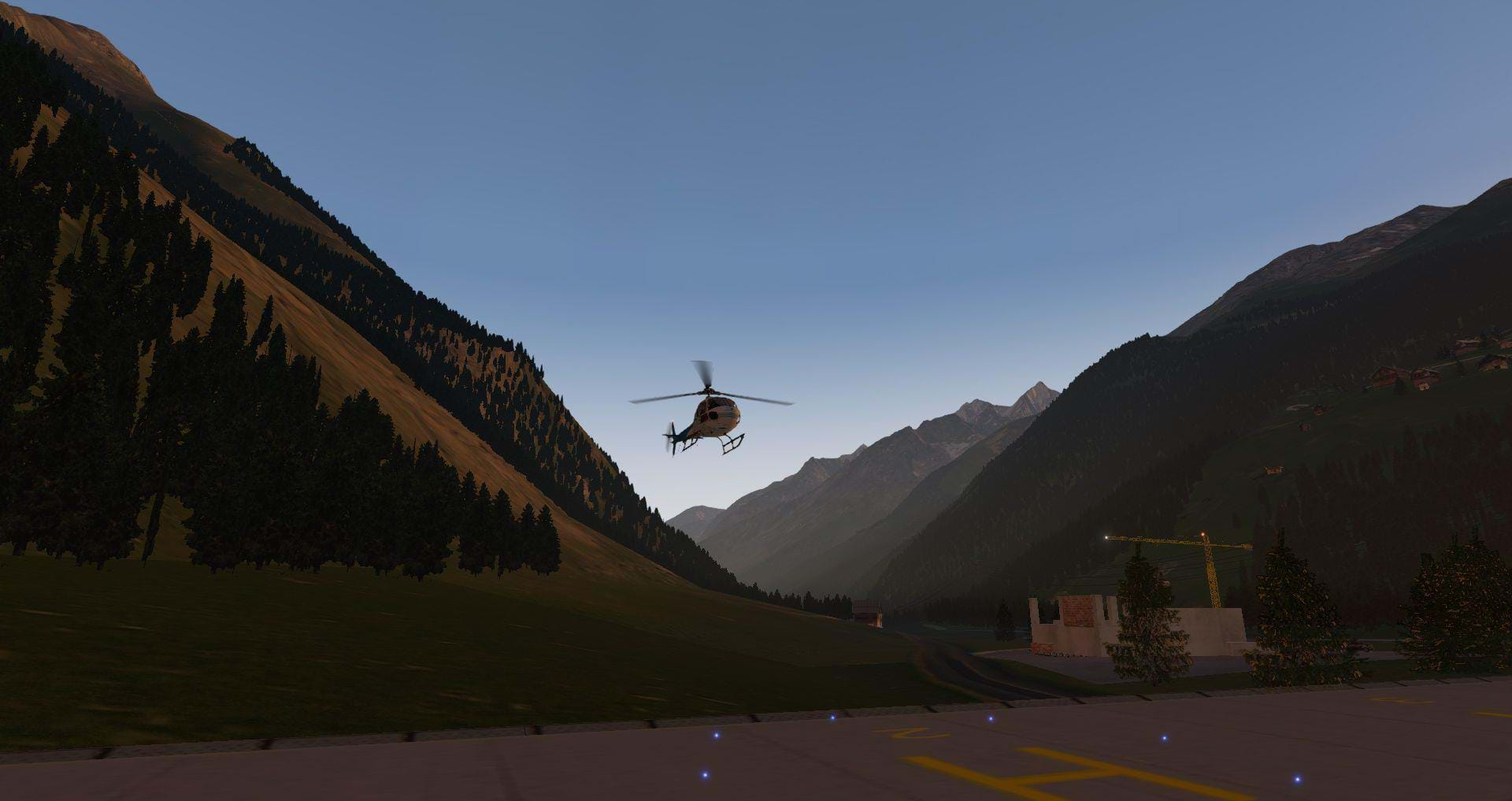
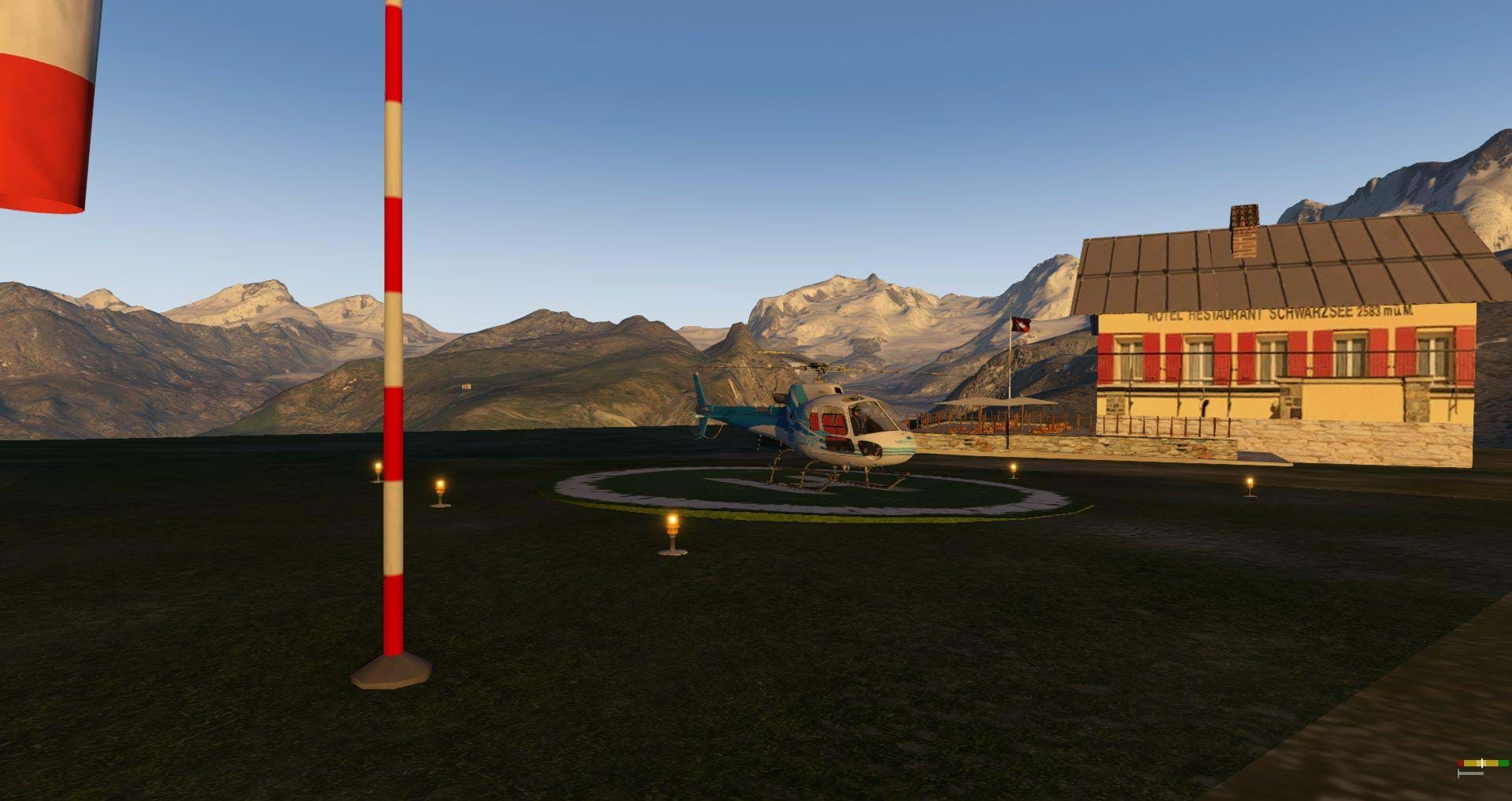
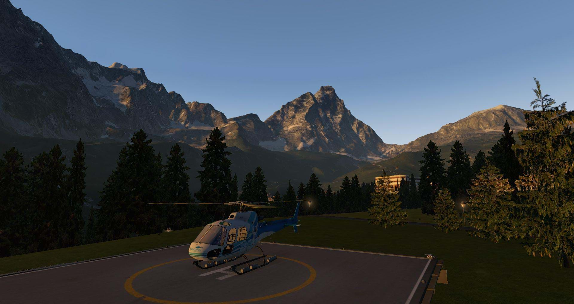
The region covers 2 cities (Cervinia and Zermatt) and comes with 2 airfields and about a dozen helipads/heliports, including the famous Air-Zermatt base.
So, no orthophoto textures?
Nope. And for a good reason. Orthophotos for this region are amazingly expensive and that cost would, obviously, had to pass on to the clients. Mr. Dainese decided against it. And, in my opinion, that was a good call as it allowed him to lower the price on a region that, trust me, you WILL want to fly at.
You can read more about this matter on the manual:
“The whole territory has been rebuilt on a photographic basis but without the use of orthophotos. All the vegetation has been mapped and faithfully reproduced in 3D. The houses are reconstructed in 3D according to a typology typical of mountain areas, but also with many buildings reproduced in the two locations, and even if simplified, very well recognizable. In addition, more the main sub-structures have been added (Tralicci, roads, railway ...)”.
So, no; there are no orthophotos textures. But that doesn’t mean Frank didn’t go the extra mile to make it an amazingly good-looking scenery. And that shows.
Building a mountain
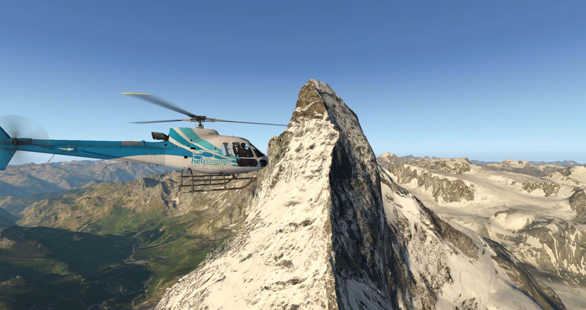
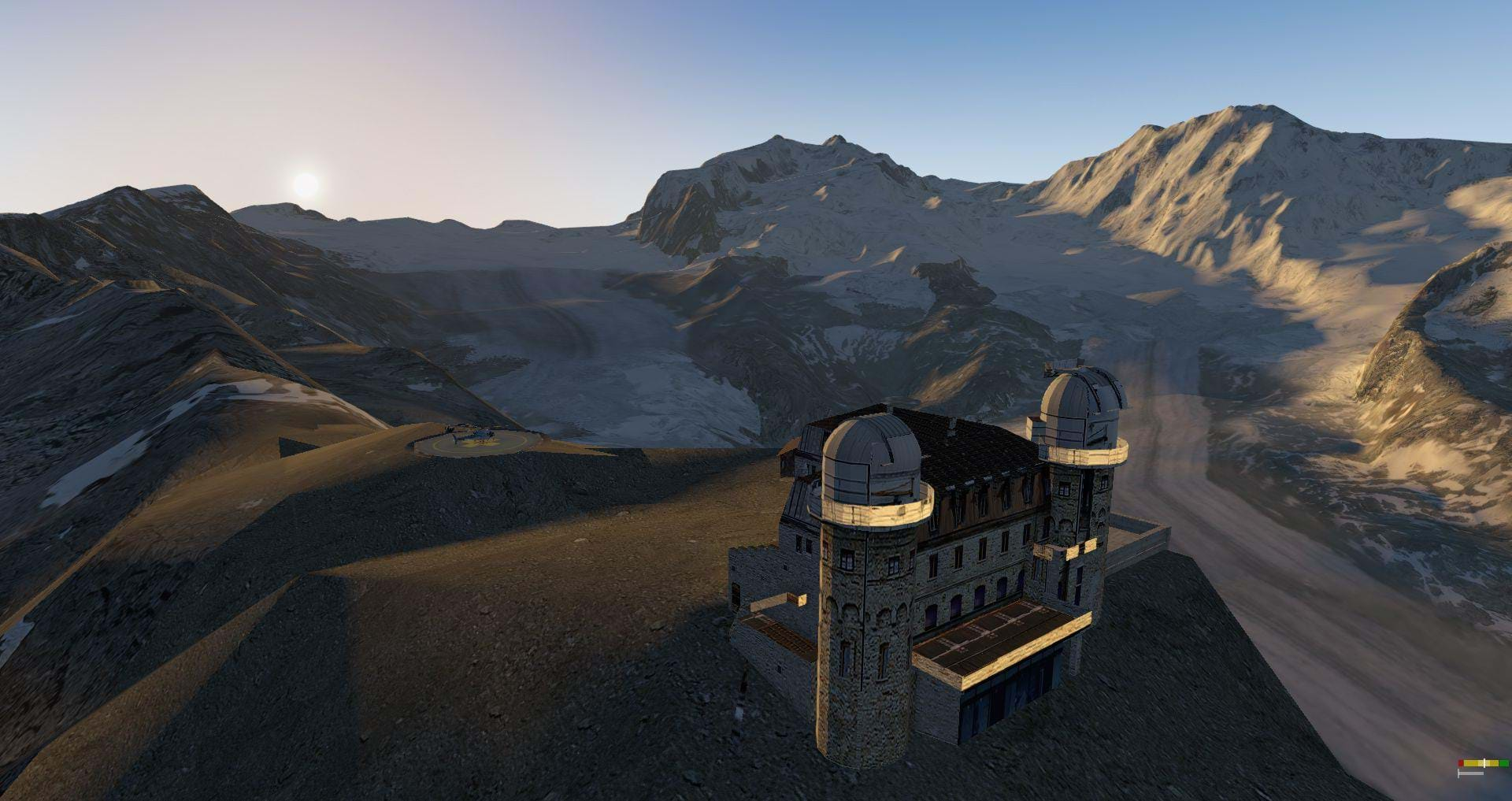
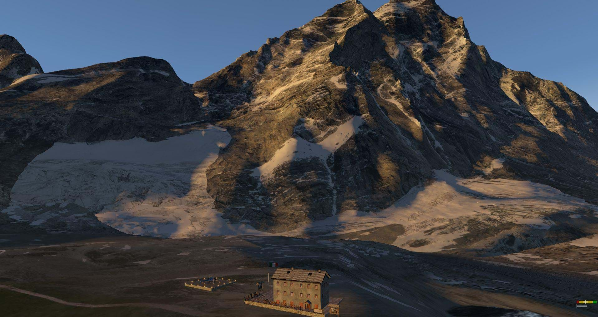
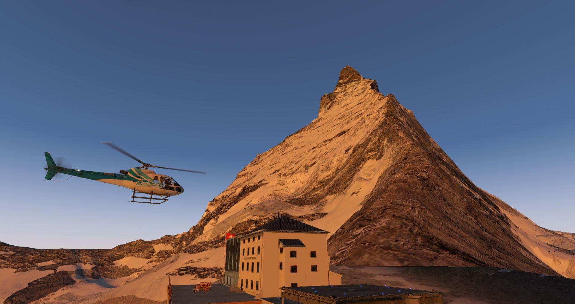
The main feature of the scenery is, of course, the Matterhorn, the huge pyramid-like mountain that you simply can’t miss.
Again, Frank went the extra mile to reproduce it:
”The protagonist of the entire scenery, the Matterhorn has been reconstructed in 3D according to DEM (digital elevation model) at 5m / pixel and further elaborated with many structural details. All textures (over 60) based on 4K (4096x4096) are derived from HD photographs and positioned respecting the real position. This long and laborious procedure required a considerable effort, but it made the 3D model of the mountain very realistic, such as to allow a close flight to the walls without loss of quality, setting the graphic configuration always at the high quality / extreme level.”
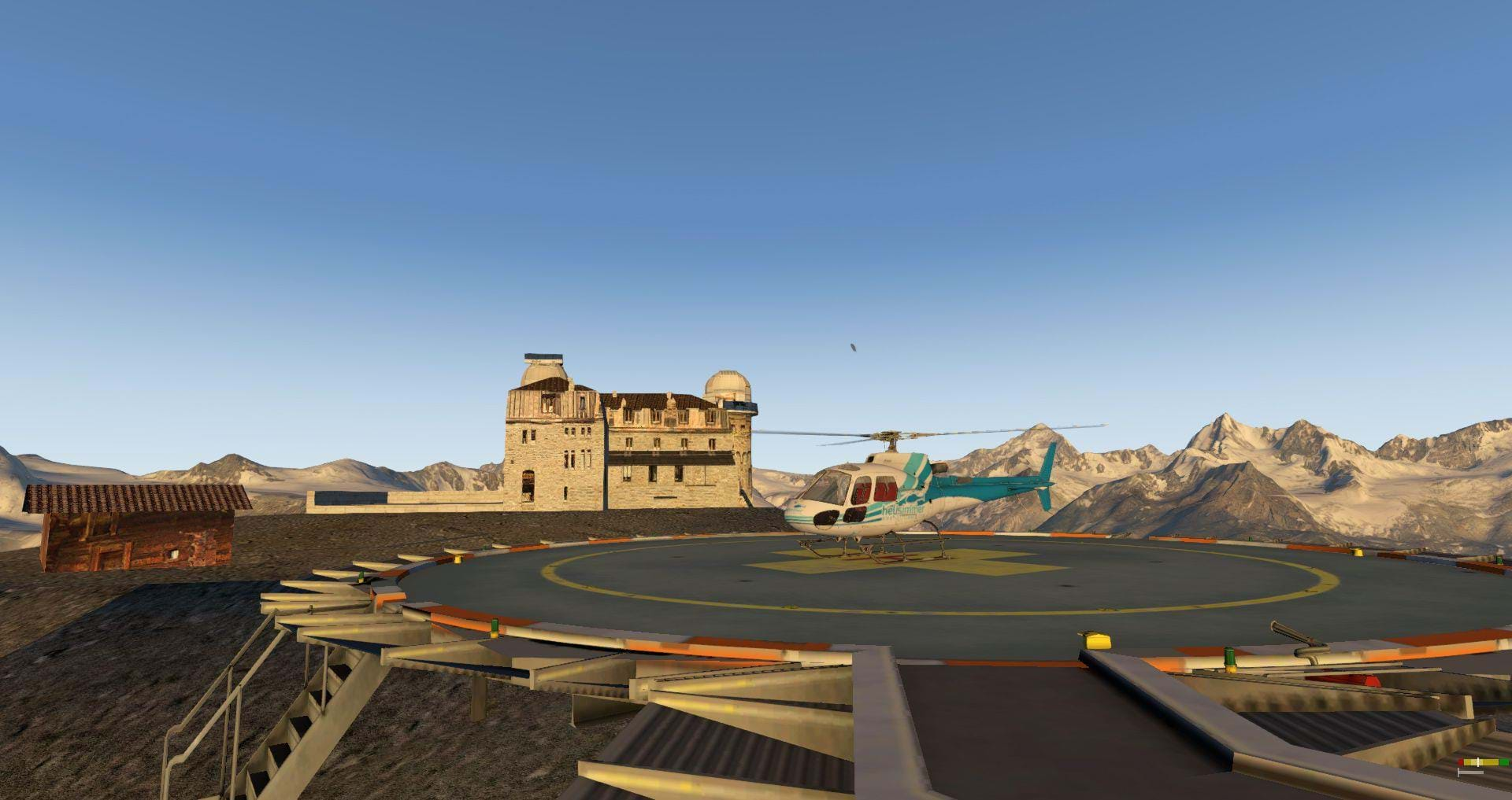
And you now one of the coolest thing in this mountain, besides being absolutely gorgeous (you HAVE to see it in VR – it’s crazy)? The hotel right next to it. With a helipad.
What’s in for the rotorheads?
If you really need to ask that, you haven’t been paying attention! An amazing scenery, great textures (no, not orthophotos but they ARE good), the cities are great-looking, there are a lot of places to land and takeoff helicopters from.
Just like Dolomiti 3D, this is a great playground for any simmer but even more so for helicopter pilots.
I love the fact that we have so many places to visit and so much to see. A lot of different scenarios can be simulated in this region: from the regular touristic routes to bringing supplies to the Gornergrat observatory, or perhaps shuttling some tourists to the luxurious hotels in the area.
Or perhaps doing some SAR flights to find a group of lost tourists.
If you own Dolomiti 3D, you can perhaps establish a connection route between the two regions.
I can’t wait to see Mr. Dainese’s next project.
Performance
Nothing to say here. I saw no major impact on X-Plane's performance or drops on the frame rate -- even in VR. The sim continues to behave in a fluid manner.
Where to get Frank Dainese’s Matterhorn
The scenery should be available by March 16th at the X-Plane.org store. We will let you know when it’s there!
According to Mr. Dainese, the scenery will cost around €20 which seems like a great price for such a great scenery.
It's out! You can find it here.