On a post at the X-Plane.org forums, Frank described the project as follows:
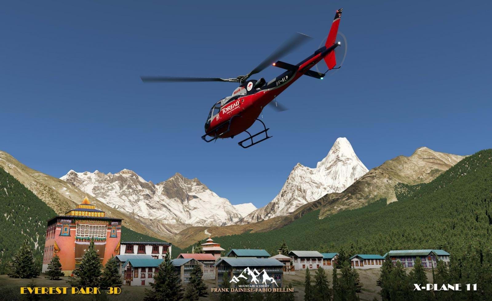
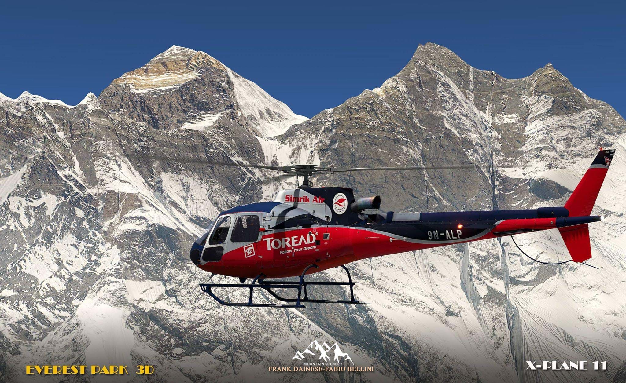
3D EVEREST PARK for X-Plane 11 is dedicated to the highest mountain on the planet: the Everest (8848mt - 29029 ft.)
It includes a territory of about 1000 square kilometers in the Himalayas along with other eight thousand, on the border between China and Nepal. Other famous mountains include the Lhotse (8516), Makalu (8463), Nuptse (7861), Pumori (7161), Ama Dablam (6812), Taboche (6543), Baruntse (7129) ...
The scenery is included in degrees +27.086 +27.087 + 28.086 +28.087.
For this scenery, given the characteristics of the territory, we decided, as for the Matterhorn, not to place the orthophotos, both for the known copyright issues and the related costs very high, but also because we thought it possible to reproduce the characteristics of the area adapting the reconstructed photographic textures, to the plot and to the chromatic and morphological variations of the terrain.
This scenery is exclusively suitable for VFR flight, only with "visual flight" it is possible to take full advantage of the characteristics of the scenery.
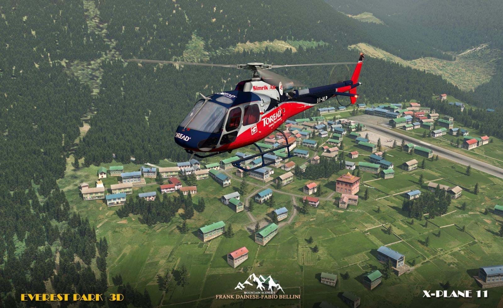
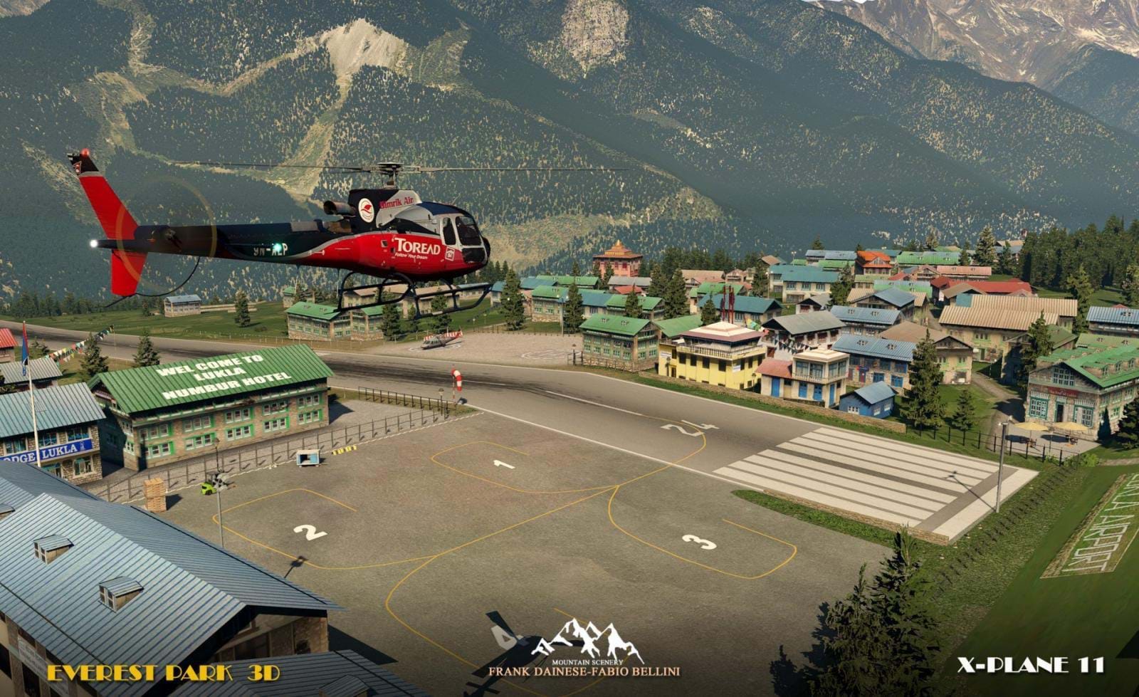
All the vegetation has been mapped and faithfully reproduced in 3D. The houses are reconstructed in 3D according to a typical typology of the Nepalese mountain areas, with buildings reproduced for both Lukla and Namche Bazar, and even if simplified, very well recognizable.
The Lukla airport (icao VNLK) is considered by the pilots, one of the most difficult especially in the landing phase, the track is just over 500 meters long. and has a significant change in slope in the initial part during take-off. But even for scenery developers it is considered just as complicated to build. We have worked on the meshes modified for this purpose, with a small addition of a 3D model in the terminal part; also reproduces the Apron area with the four parking sites.
The second airport, better avio-surface is that of Syangboche (icao VNSB) in clay ground, just over 400 meters long, secondary airport but officially coded. It is located just above the village of Namche Bazar, a mandatory stop for hikers to the Everest base camp. Much more suitable for material transfers especially of construction.
For the Heliports several landing pads have been inserted in the most important points of the scenery, normally located in residential areas, scattered at various points along the route to the base camp.
I recommend seeing the video of Fabio Bellini in the video section:
The "3D Everest park" scenery will be available from December 1, 2018 in xplane.org store.
The post also contains a few more screenshots (some of which you can see below). Read it here.
And mark it on your calendar, guys. The Everest is coming to town!